You are here: Home > Network List > GS - US Geological Survey Networks Stations List
> Station OK051 E0350 and S34600 Roads, Ralston, OK > Earthquake Result Viewer
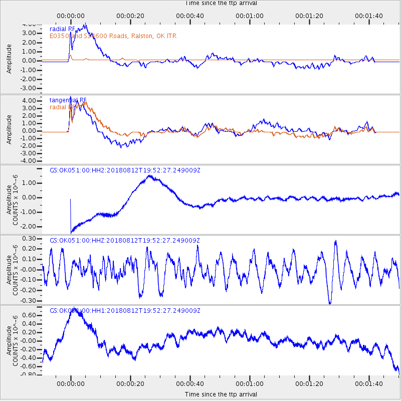
OK051 E0350 and S34600 Roads, Ralston, OK - Earthquake Result Viewer
*The percent match for this event was below the threshold and hence no stack was calculated.
| Earthquake location: |
Southeast Of Easter Island |
| Earthquake latitude/longitude: |
-35.7/-102.4 |
| Earthquake time(UTC): |
2018/08/12 (224) 19:41:34 GMT |
| Earthquake Depth: |
10 km |
| Earthquake Magnitude: |
5.6 Mww |
| Earthquake Catalog/Contributor: |
NEIC PDE/us |
|
| Network: |
GS US Geological Survey Networks |
| Station: |
OK051 E0350 and S34600 Roads, Ralston, OK |
| Lat/Lon: |
36.51 N/96.84 W |
| Elevation: |
263 m |
|
| Distance: |
72.0 deg |
| Az: |
4.685 deg |
| Baz: |
184.734 deg |
| Ray Param: |
$rayparam |
*The percent match for this event was below the threshold and hence was not used in the summary stack. |
|
| Radial Match: |
58.913322 % |
| Radial Bump: |
400 |
| Transverse Match: |
51.55686 % |
| Transverse Bump: |
400 |
| SOD ConfigId: |
2825771 |
| Insert Time: |
2018-08-26 19:45:29.597 +0000 |
| GWidth: |
2.5 |
| Max Bumps: |
400 |
| Tol: |
0.001 |
|
Signal To Noise
| Channel | StoN | STA | LTA |
| GS:OK051:00:HHZ:20180812T19:52:27.249009Z | 0.91920984 | 7.852807E-8 | 8.542997E-8 |
| GS:OK051:00:HH1:20180812T19:52:27.249009Z | 6.141838 | 1.2724134E-6 | 2.0717145E-7 |
| GS:OK051:00:HH2:20180812T19:52:27.249009Z | 1.8391101 | 1.7264792E-6 | 9.387579E-7 |
| Arrivals |
| Ps | |
| PpPs | |
| PsPs/PpSs | |


