SOL AZ.SOL - Earthquake Result Viewer
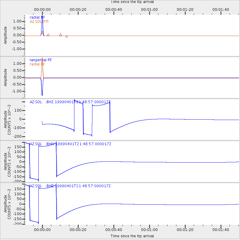
Earthquake location: New Britain Region, P.N.G.
Earthquake latitude/longitude: -4.4/152.7
Earthquake time(UTC): 1999/04/01 (091) 21:36:21 GMT
Earthquake Depth: 33 km
Earthquake Magnitude: 5.6 MB, 6.1 MS, 6.3 MW, 6.1 MW
Earthquake Catalog/Contributor: WHDF/NEIC
Network: AZ ANZA Regional Network
Station: SOL AZ.SOL
Lat/Lon: 32.84 N/117.25 W
Elevation: 245 m
Distance: 92.4 deg
Az: 57.411 deg
Baz: 266.379 deg
Ray Param: 0.041459743
Estimated Moho Depth: 10.0 km
Estimated Crust Vp/Vs: 1.60
Assumed Crust Vp: 6.264 km/s
Estimated Crust Vs: 3.915 km/s
Estimated Crust Poisson's Ratio: 0.18
Radial Match: 100.0 %
Radial Bump: 2
Transverse Match: 100.0 %
Transverse Bump: 2
SOD ConfigId: 32974
Insert Time: 2010-03-09 20:59:56.791 +0000
GWidth: 2.5
Max Bumps: 400
Tol: 0.001

Signal To Noise

ChannelStoNSTALTA
AZ:SOL: :BHN:19990401T21:48:57.000017Z1.63054110.188258630.115457766
AZ:SOL: :BHE:19990401T21:48:57.000017Z1.63053720.188267810.11546368
AZ:SOL: :BHZ:19990401T21:48:57.000017Z1.63053790.188272180.1154663
Arrivals
Ps1.0 SECOND
PpPs4.1 SECOND
PsPs/PpSs5.0 SECOND