You are here: Home > Network List > US - United States National Seismic Network Stations List
> Station CBKS Cedar Bluff, Kansas, USA > Earthquake Result Viewer
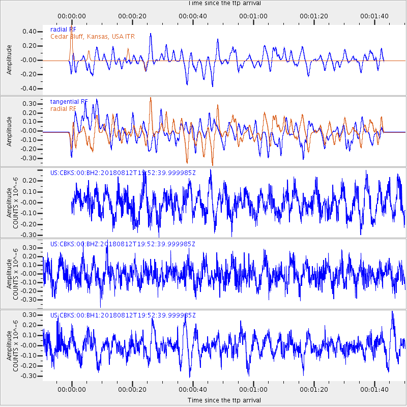
CBKS Cedar Bluff, Kansas, USA - Earthquake Result Viewer
*The percent match for this event was below the threshold and hence no stack was calculated.
| Earthquake location: |
Southeast Of Easter Island |
| Earthquake latitude/longitude: |
-35.7/-102.4 |
| Earthquake time(UTC): |
2018/08/12 (224) 19:41:34 GMT |
| Earthquake Depth: |
10 km |
| Earthquake Magnitude: |
5.6 Mww |
| Earthquake Catalog/Contributor: |
NEIC PDE/us |
|
| Network: |
US United States National Seismic Network |
| Station: |
CBKS Cedar Bluff, Kansas, USA |
| Lat/Lon: |
38.81 N/99.74 W |
| Elevation: |
677 m |
|
| Distance: |
74.2 deg |
| Az: |
2.137 deg |
| Baz: |
182.227 deg |
| Ray Param: |
$rayparam |
*The percent match for this event was below the threshold and hence was not used in the summary stack. |
|
| Radial Match: |
42.9081 % |
| Radial Bump: |
400 |
| Transverse Match: |
55.19331 % |
| Transverse Bump: |
400 |
| SOD ConfigId: |
2825771 |
| Insert Time: |
2018-08-26 19:48:21.524 +0000 |
| GWidth: |
2.5 |
| Max Bumps: |
400 |
| Tol: |
0.001 |
|
Signal To Noise
| Channel | StoN | STA | LTA |
| US:CBKS:00:BHZ:20180812T19:52:39.999985Z | 1.0500815 | 1.08221506E-7 | 1.030601E-7 |
| US:CBKS:00:BH1:20180812T19:52:39.999985Z | 0.8651112 | 9.6632E-8 | 1.1169894E-7 |
| US:CBKS:00:BH2:20180812T19:52:39.999985Z | 0.7766846 | 8.325899E-8 | 1.0719794E-7 |
| Arrivals |
| Ps | |
| PpPs | |
| PsPs/PpSs | |


