SOL AZ.SOL - Earthquake Result Viewer
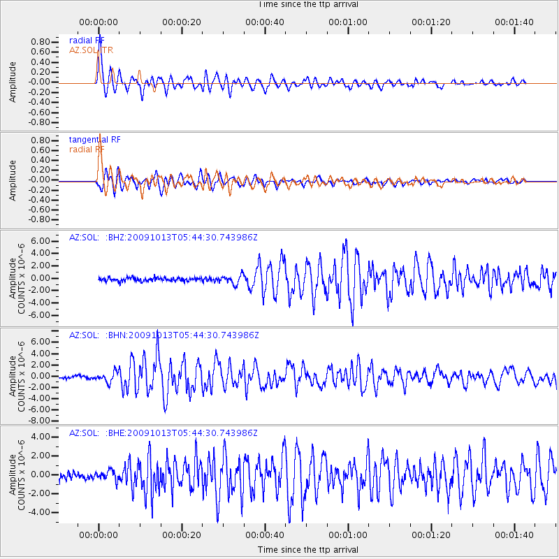
Earthquake location: Fox Islands, Aleutian Islands
Earthquake latitude/longitude: 52.8/-167.0
Earthquake time(UTC): 2009/10/13 (286) 05:37:23 GMT
Earthquake Depth: 24 km
Earthquake Magnitude: 6.0 MB, 6.1 MS, 6.5 MW, 6.5 MW
Earthquake Catalog/Contributor: WHDF/NEIC
Network: AZ ANZA Regional Network
Station: SOL AZ.SOL
Lat/Lon: 32.84 N/117.25 W
Elevation: 245 m
Distance: 40.6 deg
Az: 99.183 deg
Baz: 314.54 deg
Ray Param: 0.07426638
Estimated Moho Depth: 18.25 km
Estimated Crust Vp/Vs: 1.88
Assumed Crust Vp: 6.264 km/s
Estimated Crust Vs: 3.332 km/s
Estimated Crust Poisson's Ratio: 0.30
Radial Match: 94.24413 %
Radial Bump: 400
Transverse Match: 88.549286 %
Transverse Bump: 400
SOD ConfigId: 2622
Insert Time: 2010-03-09 21:01:15.988 +0000
GWidth: 2.5
Max Bumps: 400
Tol: 0.001

Signal To Noise

ChannelStoNSTALTA
AZ:SOL: :BHN:20091013T05:44:30.743986Z3.5290228.8609613E-72.5108832E-7
AZ:SOL: :BHE:20091013T05:44:30.743986Z1.2224225.0408715E-74.123675E-7
AZ:SOL: :BHZ:20091013T05:44:30.743986Z2.66124637.1899376E-72.7017182E-7
Arrivals
Ps2.7 SECOND
PpPs7.9 SECOND
PsPs/PpSs11 SECOND