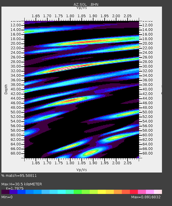
SOL AZ.SOL - Earthquake Result Viewer
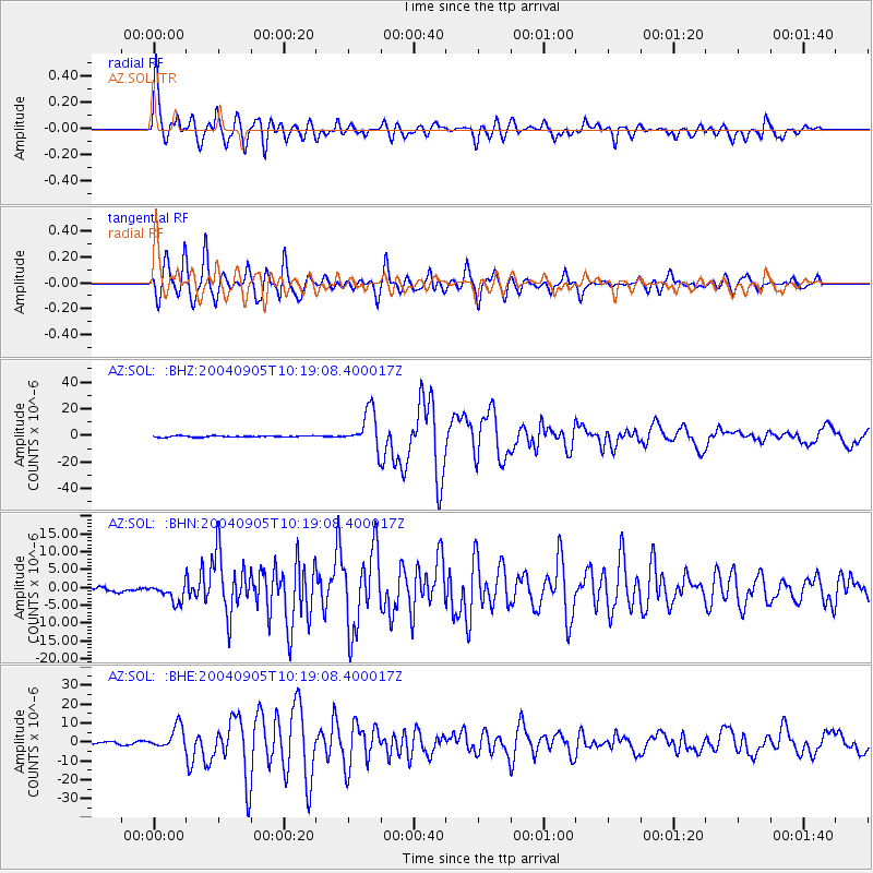
Earthquake location: Near S. Coast Of Western Honshu
Earthquake latitude/longitude: 33.1/136.6
Earthquake time(UTC): 2004/09/05 (249) 10:07:07 GMT
Earthquake Depth: 14 km
Earthquake Magnitude: 6.7 MB, 7.0 MS, 7.2 MW, 7.0 MW
Earthquake Catalog/Contributor: WHDF/NEIC
Network: AZ ANZA Regional Network
Station: SOL AZ.SOL
Lat/Lon: 32.84 N/117.25 W
Elevation: 245 m
Distance: 84.5 deg
Az: 54.339 deg
Baz: 305.865 deg
Ray Param: 0.045466866
Estimated Moho Depth: 30.5 km
Estimated Crust Vp/Vs: 1.79
Assumed Crust Vp: 6.264 km/s
Estimated Crust Vs: 3.504 km/s
Estimated Crust Poisson's Ratio: 0.27
Radial Match: 95.58811 %
Radial Bump: 400
Transverse Match: 93.97173 %
Transverse Bump: 400
SOD ConfigId: 2459
Insert Time: 2010-03-09 21:02:51.873 +0000
GWidth: 2.5
Max Bumps: 400
Tol: 0.001

Signal To Noise

ChannelStoNSTALTA
AZ:SOL: :BHN:20040905T10:19:08.400017Z2.68577082.6303794E-69.79376E-7
AZ:SOL: :BHE:20040905T10:19:08.400017Z7.9071075.8936184E-67.4535706E-7
AZ:SOL: :BHZ:20040905T10:19:08.400017Z27.588191.3969701E-55.0636527E-7
Arrivals
Ps3.9 SECOND
PpPs13 SECOND
PsPs/PpSs17 SECOND