You are here: Home > Network List > AZ - ANZA Regional Network Stations List
> Station SOL AZ.SOL > Earthquake Result Viewer
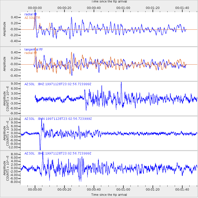
SOL AZ.SOL - Earthquake Result Viewer
*The percent match for this event was below the threshold and hence no stack was calculated.
| Earthquake location: |
Peru-Bolivia Border Region |
| Earthquake latitude/longitude: |
-13.7/-68.8 |
| Earthquake time(UTC): |
1997/11/28 (332) 22:53:41 GMT |
| Earthquake Depth: |
586 km |
| Earthquake Magnitude: |
6.4 MB, 6.6 UNKNOWN, 6.6 MW |
| Earthquake Catalog/Contributor: |
WHDF/NEIC |
|
| Network: |
AZ ANZA Regional Network |
| Station: |
SOL AZ.SOL |
| Lat/Lon: |
32.84 N/117.25 W |
| Elevation: |
245 m |
|
| Distance: |
65.5 deg |
| Az: |
316.164 deg |
| Baz: |
126.92 deg |
| Ray Param: |
$rayparam |
*The percent match for this event was below the threshold and hence was not used in the summary stack. |
|
| Radial Match: |
75.997955 % |
| Radial Bump: |
400 |
| Transverse Match: |
78.7395 % |
| Transverse Bump: |
400 |
| SOD ConfigId: |
4480 |
| Insert Time: |
2010-03-09 21:05:21.114 +0000 |
| GWidth: |
2.5 |
| Max Bumps: |
400 |
| Tol: |
0.001 |
|
Signal To Noise
| Channel | StoN | STA | LTA |
| AZ:SOL: :BHN:19971128T23:02:56.723999Z | 8.590448 | 5.009643E-6 | 5.831643E-7 |
| AZ:SOL: :BHE:19971128T23:02:56.723999Z | 1.9054661 | 1.6329788E-6 | 8.56997E-7 |
| AZ:SOL: :BHZ:19971128T23:02:56.723999Z | 2.6252885 | 2.2864856E-6 | 8.709464E-7 |
| Arrivals |
| Ps | |
| PpPs | |
| PsPs/PpSs | |


