You are here: Home > Network List > US - United States National Seismic Network Stations List
> Station HAWA Hanford, Washington, USA > Earthquake Result Viewer
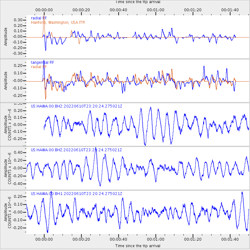
HAWA Hanford, Washington, USA - Earthquake Result Viewer
*The percent match for this event was below the threshold and hence no stack was calculated.
| Earthquake location: |
East Of North Island, N.Z. |
| Earthquake latitude/longitude: |
-35.1/-179.6 |
| Earthquake time(UTC): |
2022/06/10 (161) 23:07:22 GMT |
| Earthquake Depth: |
10 km |
| Earthquake Magnitude: |
5.6 mww |
| Earthquake Catalog/Contributor: |
NEIC PDE/us |
|
| Network: |
US United States National Seismic Network |
| Station: |
HAWA Hanford, Washington, USA |
| Lat/Lon: |
46.39 N/119.53 W |
| Elevation: |
364 m |
|
| Distance: |
97.5 deg |
| Az: |
37.23 deg |
| Baz: |
225.8 deg |
| Ray Param: |
$rayparam |
*The percent match for this event was below the threshold and hence was not used in the summary stack. |
|
| Radial Match: |
61.025322 % |
| Radial Bump: |
400 |
| Transverse Match: |
49.53612 % |
| Transverse Bump: |
400 |
| SOD ConfigId: |
28208852 |
| Insert Time: |
2022-06-27 18:52:54.463 +0000 |
| GWidth: |
2.5 |
| Max Bumps: |
400 |
| Tol: |
0.001 |
|
Signal To Noise
| Channel | StoN | STA | LTA |
| US:HAWA:00:BHZ:20220610T23:20:24.275021Z | 0.79902565 | 1.1097185E-7 | 1.3888396E-7 |
| US:HAWA:00:BH1:20220610T23:20:24.275021Z | 2.5869637 | 1.6810488E-7 | 6.4981535E-8 |
| US:HAWA:00:BH2:20220610T23:20:24.275021Z | 1.4263777 | 1.0914798E-7 | 7.65211E-8 |
| Arrivals |
| Ps | |
| PpPs | |
| PsPs/PpSs | |


