
UT53 Utah53 - Earthquake Result Viewer
| ||||||||||||||||||
| ||||||||||||||||||
| ||||||||||||||||||
|
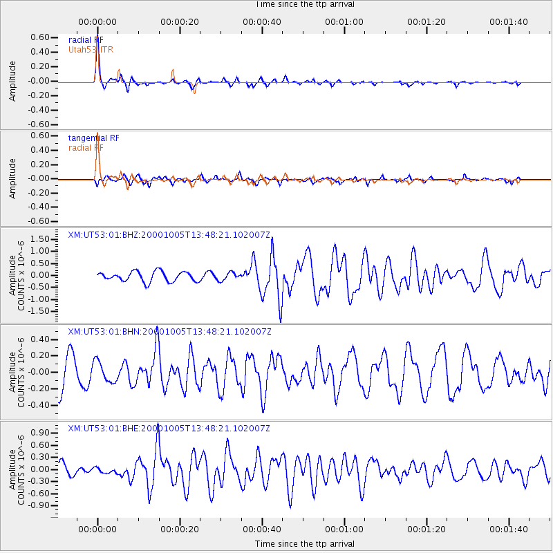
Signal To Noise
| Channel | StoN | STA | LTA |
| XM:UT53:01:BHN:20001005T13:48:21.102007Z | 0.6139554 | 1.2751244E-7 | 2.0769008E-7 |
| XM:UT53:01:BHE:20001005T13:48:21.102007Z | 0.4655847 | 6.2397056E-8 | 1.340187E-7 |
| XM:UT53:01:BHZ:20001005T13:48:21.102007Z | 0.7937281 | 1.6147754E-7 | 2.0344189E-7 |
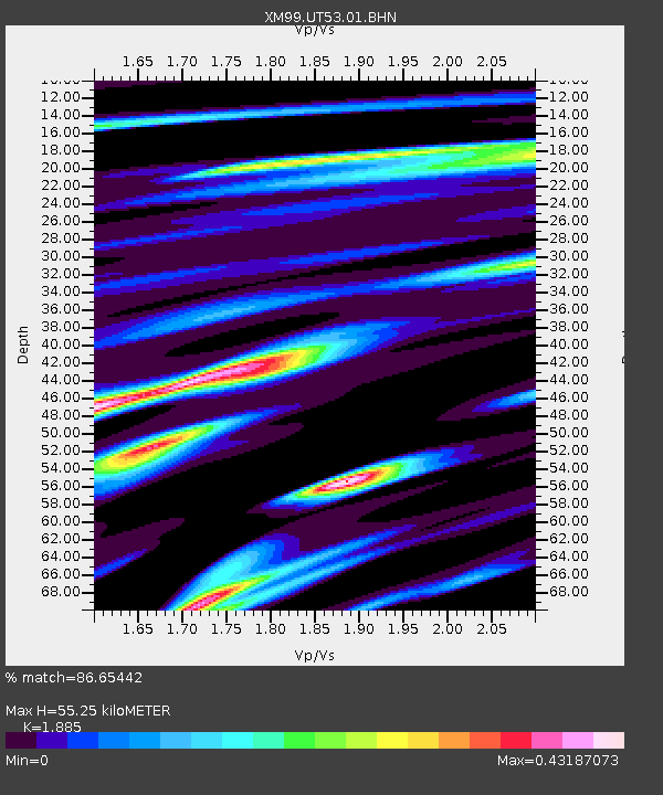
| Arrivals | |
| Ps | 8.2 SECOND |
| PpPs | 24 SECOND |
| PsPs/PpSs | 33 SECOND |

