
UT53 Utah53 - Earthquake Result Viewer
| ||||||||||||||||||
| ||||||||||||||||||
| ||||||||||||||||||
|
Signal To Noise
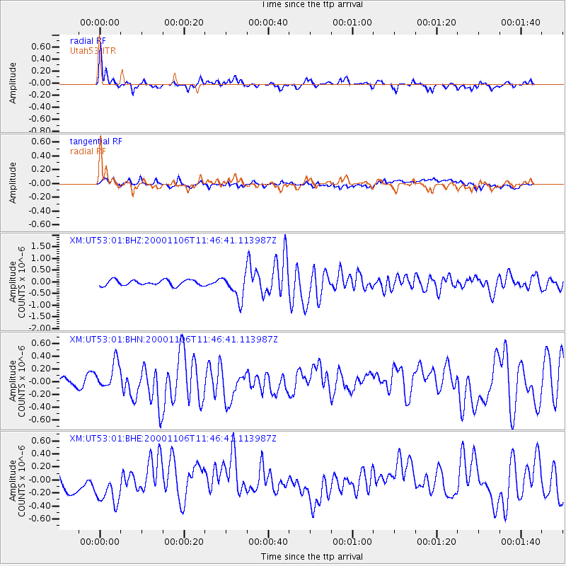
| Channel | StoN | STA | LTA |
| XM:UT53:01:BHN:20001106T11:46:41.113987Z | 1.8197503 | 2.1648097E-7 | 1.1896191E-7 |
| XM:UT53:01:BHE:20001106T11:46:41.113987Z | 1.932821 | 3.2871415E-7 | 1.7006964E-7 |
| XM:UT53:01:BHZ:20001106T11:46:41.113987Z | 4.5851564 | 5.410143E-7 | 1.1799255E-7 |
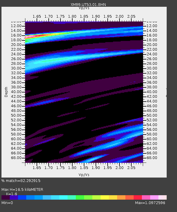
| Arrivals | |
| Ps | 1.7 SECOND |
| PpPs | 6.3 SECOND |
| PsPs/PpSs | 8.1 SECOND |

