You are here: Home > Network List > IW - Intermountain West Stations List
> Station MOOW Moose Ponds, Wyoming, USA > Earthquake Result Viewer
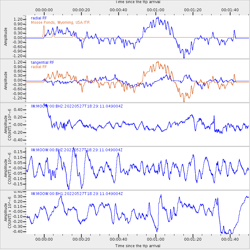
MOOW Moose Ponds, Wyoming, USA - Earthquake Result Viewer
*The percent match for this event was below the threshold and hence no stack was calculated.
| Earthquake location: |
Northern East Pacific Rise |
| Earthquake latitude/longitude: |
8.4/-103.0 |
| Earthquake time(UTC): |
2022/05/27 (147) 18:22:42 GMT |
| Earthquake Depth: |
10 km |
| Earthquake Magnitude: |
5.4 Mww |
| Earthquake Catalog/Contributor: |
NEIC PDE/us |
|
| Network: |
IW Intermountain West |
| Station: |
MOOW Moose Ponds, Wyoming, USA |
| Lat/Lon: |
43.75 N/110.74 W |
| Elevation: |
2128 m |
|
| Distance: |
35.8 deg |
| Az: |
350.374 deg |
| Baz: |
166.805 deg |
| Ray Param: |
$rayparam |
*The percent match for this event was below the threshold and hence was not used in the summary stack. |
|
| Radial Match: |
54.78064 % |
| Radial Bump: |
400 |
| Transverse Match: |
32.571598 % |
| Transverse Bump: |
400 |
| SOD ConfigId: |
28208852 |
| Insert Time: |
2022-06-27 19:39:45.676 +0000 |
| GWidth: |
2.5 |
| Max Bumps: |
400 |
| Tol: |
0.001 |
|
Signal To Noise
| Channel | StoN | STA | LTA |
| IW:MOOW:00:BHZ:20220527T18:29:11.049004Z | 0.9598787 | 5.7349975E-8 | 5.974711E-8 |
| IW:MOOW:00:BH1:20220527T18:29:11.049004Z | 0.52654636 | 8.6753126E-8 | 1.6475877E-7 |
| IW:MOOW:00:BH2:20220527T18:29:11.049004Z | 0.62793666 | 9.758255E-8 | 1.554019E-7 |
| Arrivals |
| Ps | |
| PpPs | |
| PsPs/PpSs | |


