
UT53 Utah53 - Earthquake Result Viewer
| ||||||||||||||||||
| ||||||||||||||||||
| ||||||||||||||||||
|
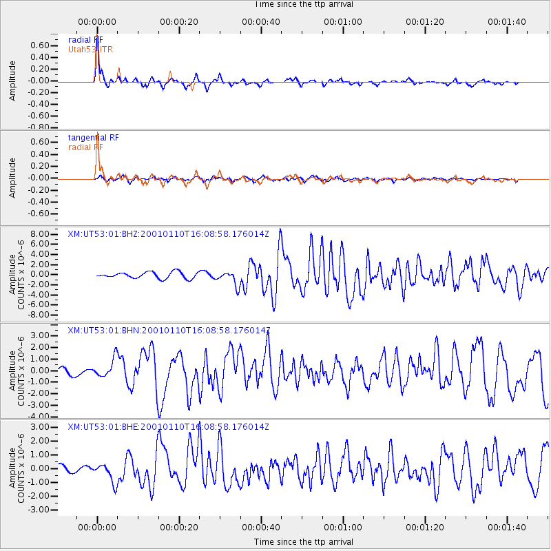
Signal To Noise
| Channel | StoN | STA | LTA |
| XM:UT53:01:BHN:20010110T16:08:58.176014Z | 2.840807 | 8.58344E-7 | 3.0214795E-7 |
| XM:UT53:01:BHE:20010110T16:08:58.176014Z | 1.9943178 | 7.297512E-7 | 3.659152E-7 |
| XM:UT53:01:BHZ:20010110T16:08:58.176014Z | 2.3921797 | 1.5096381E-6 | 6.310722E-7 |
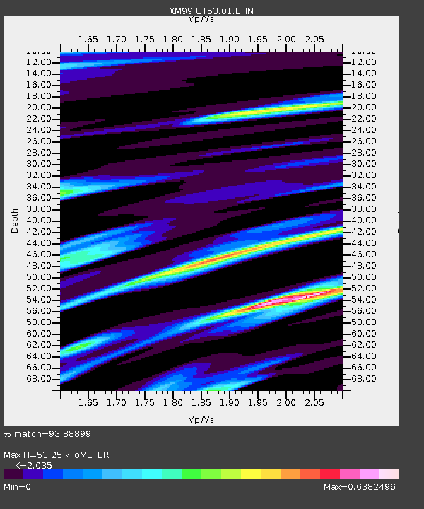
| Arrivals | |
| Ps | 9.4 SECOND |
| PpPs | 24 SECOND |
| PsPs/PpSs | 34 SECOND |

