You are here: Home > Network List > XM99 - Rio Grande Seismic Transect Stations List
> Station UT53 Utah53 > Earthquake Result Viewer
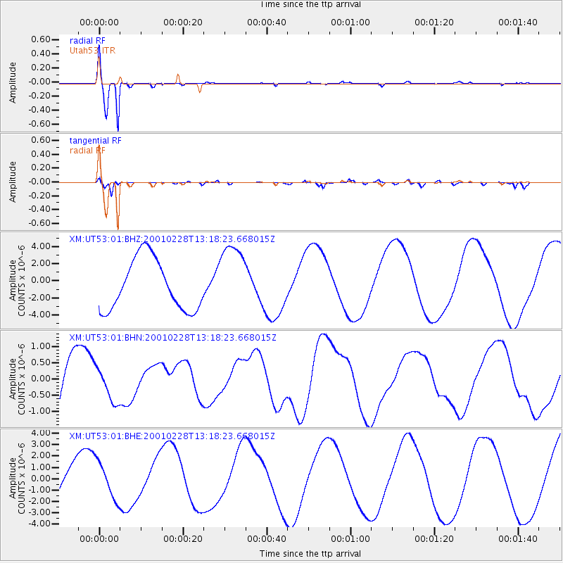
UT53 Utah53 - Earthquake Result Viewer
*The percent match for this event was below the threshold and hence no stack was calculated.
| Earthquake location: |
Southeast Of Loyalty Islands |
| Earthquake latitude/longitude: |
-22.0/170.1 |
| Earthquake time(UTC): |
2001/02/28 (059) 13:05:31 GMT |
| Earthquake Depth: |
10 km |
| Earthquake Magnitude: |
5.8 MB, 6.1 MS, 6.2 MW |
| Earthquake Catalog/Contributor: |
WHDF/NEIC |
|
| Network: |
XM Rio Grande Seismic Transect |
| Station: |
UT53 Utah53 |
| Lat/Lon: |
37.35 N/110.33 W |
| Elevation: |
1291 m |
|
| Distance: |
95.2 deg |
| Az: |
51.908 deg |
| Baz: |
246.417 deg |
| Ray Param: |
$rayparam |
*The percent match for this event was below the threshold and hence was not used in the summary stack. |
|
| Radial Match: |
97.54838 % |
| Radial Bump: |
264 |
| Transverse Match: |
86.4973 % |
| Transverse Bump: |
400 |
| SOD ConfigId: |
3744 |
| Insert Time: |
2010-02-26 17:29:21.789 +0000 |
| GWidth: |
2.5 |
| Max Bumps: |
400 |
| Tol: |
0.001 |
|
Signal To Noise
| Channel | StoN | STA | LTA |
| XM:UT53:01:BHN:20010228T13:18:23.668015Z | 0.6850102 | 5.269096E-7 | 7.6919963E-7 |
| XM:UT53:01:BHE:20010228T13:18:23.668015Z | 0.85159415 | 1.5745102E-6 | 1.8488973E-6 |
| XM:UT53:01:BHZ:20010228T13:18:23.668015Z | 1.4153644 | 4.190528E-6 | 2.9607415E-6 |
| Arrivals |
| Ps | |
| PpPs | |
| PsPs/PpSs | |


