You are here: Home > Network List > IW - Intermountain West Stations List
> Station MOOW Moose Ponds, Wyoming, USA > Earthquake Result Viewer
MOOW Moose Ponds, Wyoming, USA - Earthquake Result Viewer
*The percent match for this event was below the threshold and hence no stack was calculated.
| Earthquake location: |
Near West Coast Of Honshu, Japan |
| Earthquake latitude/longitude: |
37.5/137.3 |
| Earthquake time(UTC): |
2022/06/19 (170) 06:08:06 GMT |
| Earthquake Depth: |
10 km |
| Earthquake Magnitude: |
5.1 Mww |
| Earthquake Catalog/Contributor: |
NEIC PDE/us |
|
| Network: |
IW Intermountain West |
| Station: |
MOOW Moose Ponds, Wyoming, USA |
| Lat/Lon: |
43.75 N/110.74 W |
| Elevation: |
2128 m |
|
| Distance: |
78.3 deg |
| Az: |
43.363 deg |
| Baz: |
311.115 deg |
| Ray Param: |
$rayparam |
*The percent match for this event was below the threshold and hence was not used in the summary stack. |
|
| Radial Match: |
66.990944 % |
| Radial Bump: |
400 |
| Transverse Match: |
57.549118 % |
| Transverse Bump: |
400 |
| SOD ConfigId: |
28208852 |
| Insert Time: |
2022-07-03 06:25:56.641 +0000 |
| GWidth: |
2.5 |
| Max Bumps: |
400 |
| Tol: |
0.001 |
|
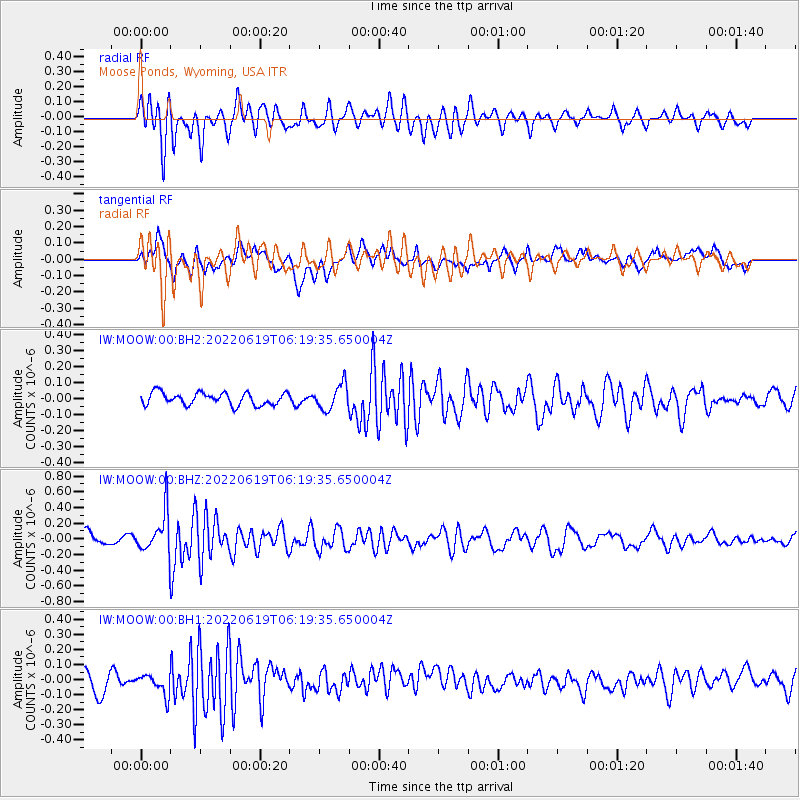
Signal To Noise
| Channel | StoN | STA | LTA |
| IW:MOOW:00:BHZ:20220619T06:19:35.650004Z | 3.1204238 | 2.6084172E-7 | 8.3591765E-8 |
| IW:MOOW:00:BH1:20220619T06:19:35.650004Z | 0.83372545 | 7.033041E-8 | 8.43568E-8 |
| IW:MOOW:00:BH2:20220619T06:19:35.650004Z | 2.0260077 | 7.82255E-8 | 3.861066E-8 |
| Arrivals |
| Ps | |
| PpPs | |
| PsPs/PpSs | |


