You are here: Home > Network List > US - United States National Seismic Network Stations List
> Station MSO Missoula, Montana, USA > Earthquake Result Viewer
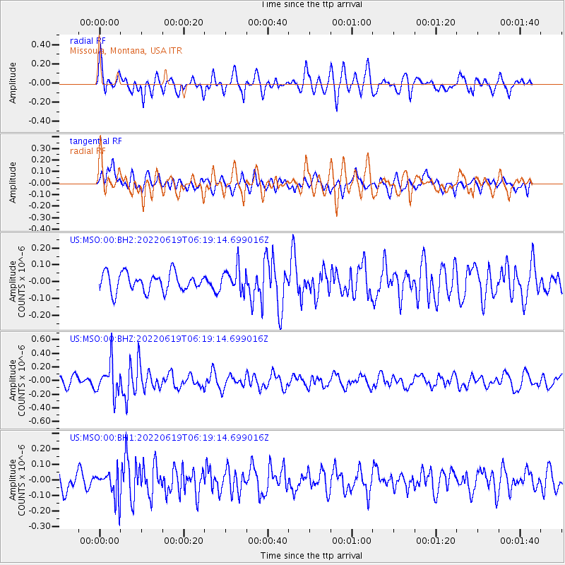
MSO Missoula, Montana, USA - Earthquake Result Viewer
*The percent match for this event was below the threshold and hence no stack was calculated.
| Earthquake location: |
Near West Coast Of Honshu, Japan |
| Earthquake latitude/longitude: |
37.5/137.3 |
| Earthquake time(UTC): |
2022/06/19 (170) 06:08:06 GMT |
| Earthquake Depth: |
10 km |
| Earthquake Magnitude: |
5.1 Mww |
| Earthquake Catalog/Contributor: |
NEIC PDE/us |
|
| Network: |
US United States National Seismic Network |
| Station: |
MSO Missoula, Montana, USA |
| Lat/Lon: |
46.83 N/113.94 W |
| Elevation: |
1264 m |
|
| Distance: |
74.6 deg |
| Az: |
42.42 deg |
| Baz: |
308.629 deg |
| Ray Param: |
$rayparam |
*The percent match for this event was below the threshold and hence was not used in the summary stack. |
|
| Radial Match: |
55.642616 % |
| Radial Bump: |
400 |
| Transverse Match: |
45.89721 % |
| Transverse Bump: |
400 |
| SOD ConfigId: |
28208852 |
| Insert Time: |
2022-07-03 06:35:26.184 +0000 |
| GWidth: |
2.5 |
| Max Bumps: |
400 |
| Tol: |
0.001 |
|
Signal To Noise
| Channel | StoN | STA | LTA |
| US:MSO:00:BHZ:20220619T06:19:14.699016Z | 2.3861282 | 2.3615058E-7 | 9.89681E-8 |
| US:MSO:00:BH1:20220619T06:19:14.699016Z | 1.1159648 | 8.976158E-8 | 8.043406E-8 |
| US:MSO:00:BH2:20220619T06:19:14.699016Z | 1.3358425 | 7.325717E-8 | 5.4839674E-8 |
| Arrivals |
| Ps | |
| PpPs | |
| PsPs/PpSs | |


