You are here: Home > Network List > US - United States National Seismic Network Stations List
> Station MSO Missoula, Montana, USA > Earthquake Result Viewer
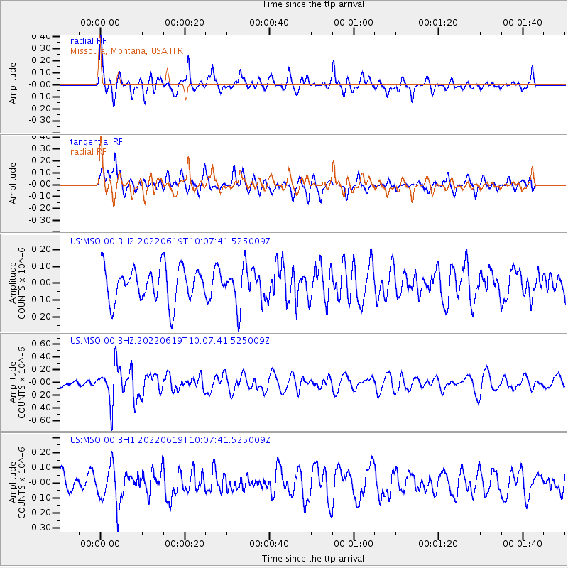
MSO Missoula, Montana, USA - Earthquake Result Viewer
*The percent match for this event was below the threshold and hence no stack was calculated.
| Earthquake location: |
Ryukyu Islands, Japan |
| Earthquake latitude/longitude: |
26.7/126.6 |
| Earthquake time(UTC): |
2022/06/19 (170) 09:55:19 GMT |
| Earthquake Depth: |
7.0 km |
| Earthquake Magnitude: |
5.5 mww |
| Earthquake Catalog/Contributor: |
NEIC PDE/us |
|
| Network: |
US United States National Seismic Network |
| Station: |
MSO Missoula, Montana, USA |
| Lat/Lon: |
46.83 N/113.94 W |
| Elevation: |
1264 m |
|
| Distance: |
88.7 deg |
| Az: |
36.707 deg |
| Baz: |
308.862 deg |
| Ray Param: |
$rayparam |
*The percent match for this event was below the threshold and hence was not used in the summary stack. |
|
| Radial Match: |
60.510468 % |
| Radial Bump: |
356 |
| Transverse Match: |
59.585922 % |
| Transverse Bump: |
400 |
| SOD ConfigId: |
28208852 |
| Insert Time: |
2022-07-03 10:16:07.570 +0000 |
| GWidth: |
2.5 |
| Max Bumps: |
400 |
| Tol: |
0.001 |
|
Signal To Noise
| Channel | StoN | STA | LTA |
| US:MSO:00:BHZ:20220619T10:07:41.525009Z | 5.000386 | 2.9230497E-7 | 5.845648E-8 |
| US:MSO:00:BH1:20220619T10:07:41.525009Z | 2.0520568 | 1.3142525E-7 | 6.404562E-8 |
| US:MSO:00:BH2:20220619T10:07:41.525009Z | 1.1540316 | 1.1951936E-7 | 1.035668E-7 |
| Arrivals |
| Ps | |
| PpPs | |
| PsPs/PpSs | |


