NM33 NewMexico33 - Earthquake Result Viewer
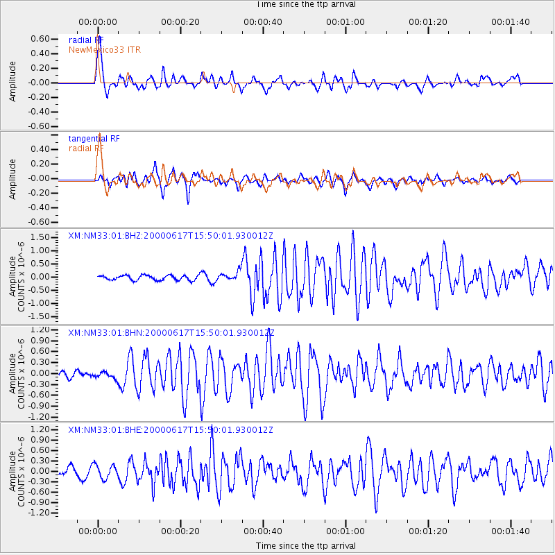
Earthquake location: Iceland
Earthquake latitude/longitude: 64.0/-20.5
Earthquake time(UTC): 2000/06/17 (169) 15:40:41 GMT
Earthquake Depth: 10 km
Earthquake Magnitude: 5.7 MB, 6.6 MS, 6.8 MW, 6.5 MW
Earthquake Catalog/Contributor: WHDF/NEIC
Network: XM Rio Grande Seismic Transect
Station: NM33 NewMexico33
Lat/Lon: 35.11 N/107.42 W
Elevation: 2094 m
Distance: 57.8 deg
Az: 284.606 deg
Baz: 31.39 deg
Ray Param: 0.06327175
Estimated Moho Depth: 10.0 km
Estimated Crust Vp/Vs: 1.60
Assumed Crust Vp: 6.502 km/s
Estimated Crust Vs: 4.063 km/s
Estimated Crust Poisson's Ratio: 0.18
Radial Match: 84.33578 %
Radial Bump: 400
Transverse Match: 80.7924 %
Transverse Bump: 400
SOD ConfigId: 27569
Insert Time: 2010-02-26 17:29:57.709 +0000
GWidth: 2.5
Max Bumps: 400
Tol: 0.001

Signal To Noise

ChannelStoNSTALTA
XM:NM33:01:BHN:20000617T15:50:01.930012Z0.68493979.4655675E-81.3819563E-7
XM:NM33:01:BHE:20000617T15:50:01.930012Z1.72342651.8803163E-71.0910337E-7
XM:NM33:01:BHZ:20000617T15:50:01.930012Z1.96936451.8368026E-79.3268795E-8
Arrivals
Ps1.0 SECOND
PpPs3.8 SECOND
PsPs/PpSs4.8 SECOND