You are here: Home > Network List > IW - Intermountain West Stations List
> Station MOOW Moose Ponds, Wyoming, USA > Earthquake Result Viewer
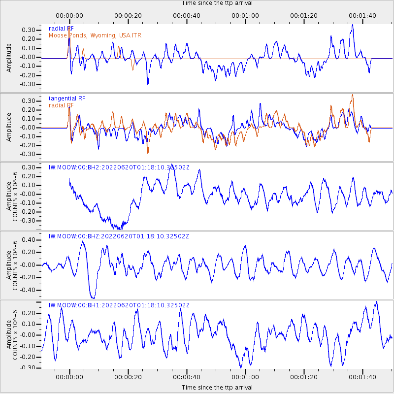
MOOW Moose Ponds, Wyoming, USA - Earthquake Result Viewer
*The percent match for this event was below the threshold and hence no stack was calculated.
| Earthquake location: |
Taiwan |
| Earthquake latitude/longitude: |
23.7/121.5 |
| Earthquake time(UTC): |
2022/06/20 (171) 01:05:07 GMT |
| Earthquake Depth: |
8.0 km |
| Earthquake Magnitude: |
5.9 mww |
| Earthquake Catalog/Contributor: |
NEIC PDE/us |
|
| Network: |
IW Intermountain West |
| Station: |
MOOW Moose Ponds, Wyoming, USA |
| Lat/Lon: |
43.75 N/110.74 W |
| Elevation: |
2128 m |
|
| Distance: |
97.6 deg |
| Az: |
35.298 deg |
| Baz: |
313.019 deg |
| Ray Param: |
$rayparam |
*The percent match for this event was below the threshold and hence was not used in the summary stack. |
|
| Radial Match: |
31.570183 % |
| Radial Bump: |
400 |
| Transverse Match: |
35.761215 % |
| Transverse Bump: |
400 |
| SOD ConfigId: |
28208852 |
| Insert Time: |
2022-07-04 01:22:49.137 +0000 |
| GWidth: |
2.5 |
| Max Bumps: |
400 |
| Tol: |
0.001 |
|
Signal To Noise
| Channel | StoN | STA | LTA |
| IW:MOOW:00:BHZ:20220620T01:18:10.32502Z | 4.563443 | 1.9111258E-7 | 4.187903E-8 |
| IW:MOOW:00:BH1:20220620T01:18:10.32502Z | 1.1265677 | 8.682965E-8 | 7.70745E-8 |
| IW:MOOW:00:BH2:20220620T01:18:10.32502Z | 2.3908865 | 3.3029457E-7 | 1.3814733E-7 |
| Arrivals |
| Ps | |
| PpPs | |
| PsPs/PpSs | |


