You are here: Home > Network List > XM99 - Rio Grande Seismic Transect Stations List
> Station NM33 NewMexico33 > Earthquake Result Viewer
NM33 NewMexico33 - Earthquake Result Viewer

| Earthquake location: |
Tonga Islands |
| Earthquake latitude/longitude: |
-15.9/-173.7 |
| Earthquake time(UTC): |
2000/09/11 (255) 17:17:53 GMT |
| Earthquake Depth: |
115 km |
| Earthquake Magnitude: |
6.0 MB, 6.3 MW, 6.3 MW |
| Earthquake Catalog/Contributor: |
WHDF/NEIC |
|
| Network: |
XM Rio Grande Seismic Transect |
| Station: |
NM33 NewMexico33 |
| Lat/Lon: |
35.11 N/107.42 W |
| Elevation: |
2094 m |
|
| Distance: |
80.7 deg |
| Az: |
49.513 deg |
| Baz: |
243.218 deg |
| Ray Param: |
0.04784848 |
| Estimated Moho Depth: |
42.0 km |
| Estimated Crust Vp/Vs: |
1.80 |
| Assumed Crust Vp: |
6.502 km/s |
| Estimated Crust Vs: |
3.622 km/s |
| Estimated Crust Poisson's Ratio: |
0.27 |
|
| Radial Match: |
88.34803 % |
| Radial Bump: |
400 |
| Transverse Match: |
82.22244 % |
| Transverse Bump: |
400 |
| SOD ConfigId: |
16820 |
| Insert Time: |
2010-02-26 17:30:16.197 +0000 |
| GWidth: |
2.5 |
| Max Bumps: |
400 |
| Tol: |
0.001 |
|
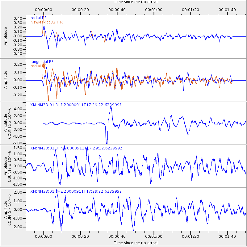
Signal To Noise
| Channel | StoN | STA | LTA |
| XM:NM33:01:BHN:20000911T17:29:22.623999Z | 0.9348988 | 2.8273774E-7 | 3.0242606E-7 |
| XM:NM33:01:BHE:20000911T17:29:22.623999Z | 1.5185212 | 4.0994428E-7 | 2.699628E-7 |
| XM:NM33:01:BHZ:20000911T17:29:22.623999Z | 12.309596 | 2.294626E-6 | 1.8640952E-7 |
| Arrivals |
| Ps | 5.3 SECOND |
| PpPs | 18 SECOND |
| PsPs/PpSs | 23 SECOND |


