You are here: Home > Network List > GS - US Geological Survey Networks Stations List
> Station KAN13 Rinehart Farm > Earthquake Result Viewer
KAN13 Rinehart Farm - Earthquake Result Viewer
*The percent match for this event was below the threshold and hence no stack was calculated.
| Earthquake location: |
Andreanof Islands, Aleutian Is. |
| Earthquake latitude/longitude: |
51.4/-178.1 |
| Earthquake time(UTC): |
2018/08/15 (227) 21:56:54 GMT |
| Earthquake Depth: |
20 km |
| Earthquake Magnitude: |
6.6 Mww |
| Earthquake Catalog/Contributor: |
NEIC PDE/us |
|
| Network: |
GS US Geological Survey Networks |
| Station: |
KAN13 Rinehart Farm |
| Lat/Lon: |
37.01 N/97.48 W |
| Elevation: |
340 m |
|
| Distance: |
56.7 deg |
| Az: |
70.928 deg |
| Baz: |
312.346 deg |
| Ray Param: |
$rayparam |
*The percent match for this event was below the threshold and hence was not used in the summary stack. |
|
| Radial Match: |
44.750477 % |
| Radial Bump: |
400 |
| Transverse Match: |
25.6097 % |
| Transverse Bump: |
400 |
| SOD ConfigId: |
2825771 |
| Insert Time: |
2018-08-29 22:05:18.472 +0000 |
| GWidth: |
2.5 |
| Max Bumps: |
400 |
| Tol: |
0.001 |
|
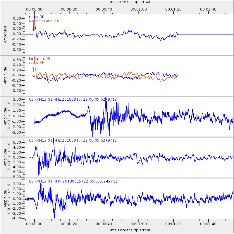
Signal To Noise
| Channel | StoN | STA | LTA |
| GS:KAN13:01:HHZ:20180815T22:06:05.624971Z | 46.255356 | 2.8886059E-6 | 6.2449104E-8 |
| GS:KAN13:01:HHN:20180815T22:06:05.624971Z | 1.8342968 | 1.1975529E-6 | 6.528676E-7 |
| GS:KAN13:01:HHE:20180815T22:06:05.624971Z | 1.9914969 | 1.3321242E-6 | 6.6890595E-7 |
| Arrivals |
| Ps | |
| PpPs | |
| PsPs/PpSs | |


