You are here: Home > Network List > US - United States National Seismic Network Stations List
> Station WMOK Wichita Mountains, Oklahoma, USA > Earthquake Result Viewer
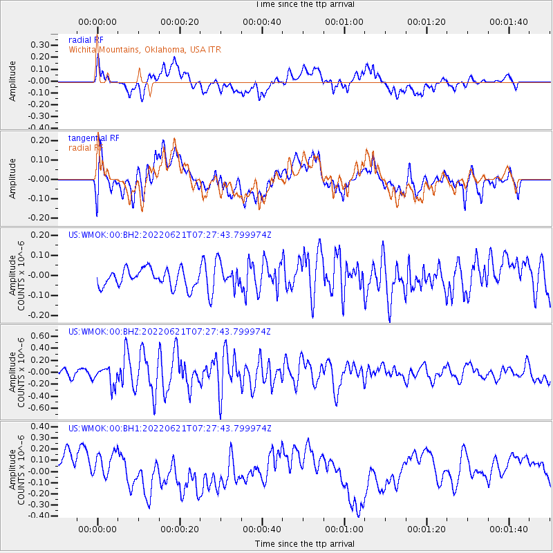
WMOK Wichita Mountains, Oklahoma, USA - Earthquake Result Viewer
*The percent match for this event was below the threshold and hence no stack was calculated.
| Earthquake location: |
Bonin Islands, Japan Region |
| Earthquake latitude/longitude: |
28.0/142.8 |
| Earthquake time(UTC): |
2022/06/21 (172) 07:14:54 GMT |
| Earthquake Depth: |
10 km |
| Earthquake Magnitude: |
5.9 mww |
| Earthquake Catalog/Contributor: |
NEIC PDE/us |
|
| Network: |
US United States National Seismic Network |
| Station: |
WMOK Wichita Mountains, Oklahoma, USA |
| Lat/Lon: |
34.74 N/98.78 W |
| Elevation: |
486 m |
|
| Distance: |
94.7 deg |
| Az: |
46.623 deg |
| Baz: |
308.673 deg |
| Ray Param: |
$rayparam |
*The percent match for this event was below the threshold and hence was not used in the summary stack. |
|
| Radial Match: |
30.920614 % |
| Radial Bump: |
400 |
| Transverse Match: |
32.33387 % |
| Transverse Bump: |
400 |
| SOD ConfigId: |
28208852 |
| Insert Time: |
2022-07-05 07:43:49.545 +0000 |
| GWidth: |
2.5 |
| Max Bumps: |
400 |
| Tol: |
0.001 |
|
Signal To Noise
| Channel | StoN | STA | LTA |
| US:WMOK:00:BHZ:20220621T07:27:43.799974Z | 3.3390837 | 1.5480377E-7 | 4.636115E-8 |
| US:WMOK:00:BH1:20220621T07:27:43.799974Z | 1.2330458 | 1.5892937E-7 | 1.2889168E-7 |
| US:WMOK:00:BH2:20220621T07:27:43.799974Z | 1.335106 | 5.8161646E-8 | 4.3563315E-8 |
| Arrivals |
| Ps | |
| PpPs | |
| PsPs/PpSs | |


