NM33 NewMexico33 - Earthquake Result Viewer
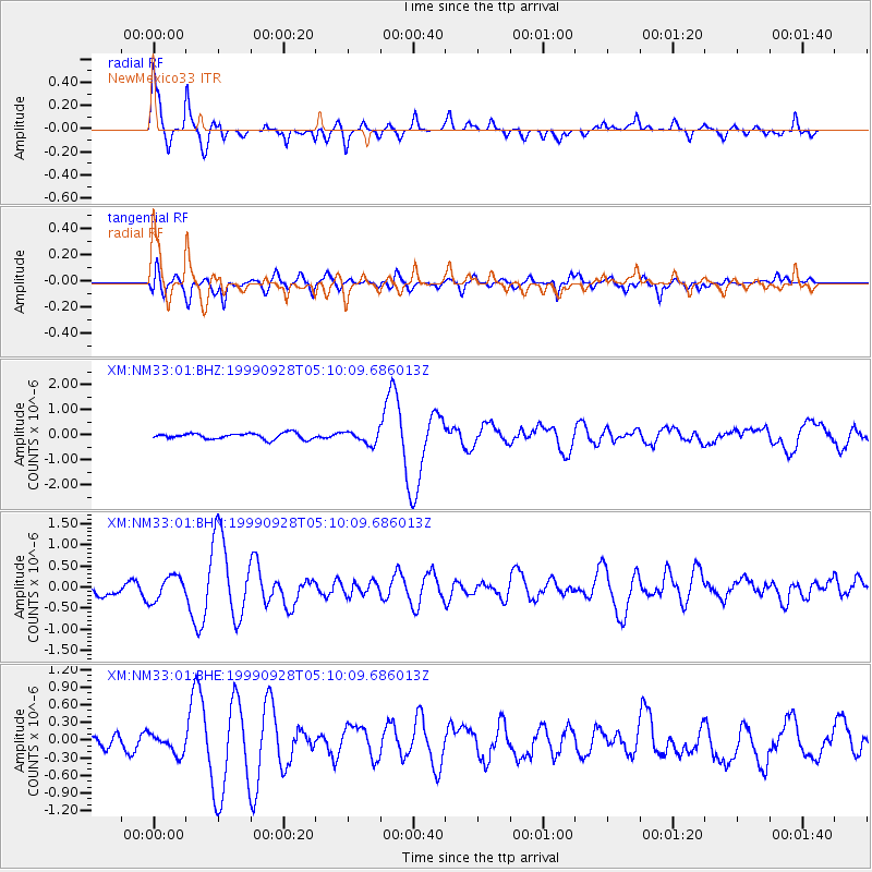
Earthquake location: Komandorskiye Ostrova Region
Earthquake latitude/longitude: 54.6/168.3
Earthquake time(UTC): 1999/09/28 (271) 05:00:42 GMT
Earthquake Depth: 33 km
Earthquake Magnitude: 5.4 MB, 6.1 MS, 6.1 MW, 6.1 MW
Earthquake Catalog/Contributor: WHDF/NEIC
Network: XM Rio Grande Seismic Transect
Station: NM33 NewMexico33
Lat/Lon: 35.11 N/107.42 W
Elevation: 2094 m
Distance: 59.1 deg
Az: 71.866 deg
Baz: 317.574 deg
Ray Param: 0.062325116
Estimated Moho Depth: 42.75 km
Estimated Crust Vp/Vs: 1.75
Assumed Crust Vp: 6.502 km/s
Estimated Crust Vs: 3.71 km/s
Estimated Crust Poisson's Ratio: 0.26
Radial Match: 86.00001 %
Radial Bump: 366
Transverse Match: 72.13242 %
Transverse Bump: 400
SOD ConfigId: 27569
Insert Time: 2010-02-26 17:30:32.219 +0000
GWidth: 2.5
Max Bumps: 400
Tol: 0.001

Signal To Noise

ChannelStoNSTALTA
XM:NM33:01:BHN:19990928T05:10:09.686013Z1.87823052.8544315E-71.519745E-7
XM:NM33:01:BHE:19990928T05:10:09.686013Z1.37730791.5923895E-71.1561609E-7
XM:NM33:01:BHZ:19990928T05:10:09.686013Z2.09034352.5023425E-71.1970963E-7
Arrivals
Ps5.2 SECOND
PpPs17 SECOND
PsPs/PpSs22 SECOND