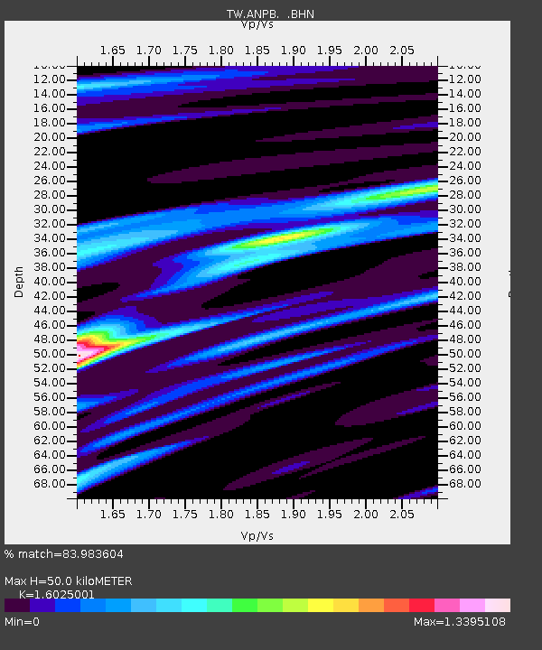
ANPB AN-PU - Earthquake Result Viewer

Earthquake location: Southern Sumatra, Indonesia
Earthquake latitude/longitude: -4.7/102.6
Earthquake time(UTC): 2001/02/13 (044) 19:28:30 GMT
Earthquake Depth: 36 km
Earthquake Magnitude: 6.2 MB, 7.2 MS, 7.4 MW, 7.0 ME
Earthquake Catalog/Contributor: WHDF/NEIC
Network: TW Broadband Array in Taiwan for Seismology
Station: ANPB AN-PU
Lat/Lon: 25.19 N/121.52 E
Elevation: 825 m
Distance: 34.9 deg
Az: 30.927 deg
Baz: 214.43 deg
Ray Param: 0.07741403
Estimated Moho Depth: 50.0 km
Estimated Crust Vp/Vs: 1.60
Assumed Crust Vp: 6.289 km/s
Estimated Crust Vs: 3.924 km/s
Estimated Crust Poisson's Ratio: 0.18
Radial Match: 83.983604 %
Radial Bump: 400
Transverse Match: 56.890797 %
Transverse Bump: 400
SOD ConfigId: 3744
Insert Time: 2010-03-09 21:28:01.990 +0000
GWidth: 2.5
Max Bumps: 400
Tol: 0.001

Signal To Noise

ChannelStoNSTALTA
TW:ANPB: :BHN:20010213T19:34:48.387014Z0.630017464.04921E-66.427139E-6
TW:ANPB: :BHE:20010213T19:34:48.387014Z0.788744153.994636E-65.0645526E-6
TW:ANPB: :BHZ:20010213T19:34:48.387014Z0.53273664.6215973E-68.6752025E-6
Arrivals
Ps5.2 SECOND
PpPs19 SECOND
PsPs/PpSs24 SECOND