You are here: Home > Network List > XM99 - Rio Grande Seismic Transect Stations List
> Station NM33 NewMexico33 > Earthquake Result Viewer
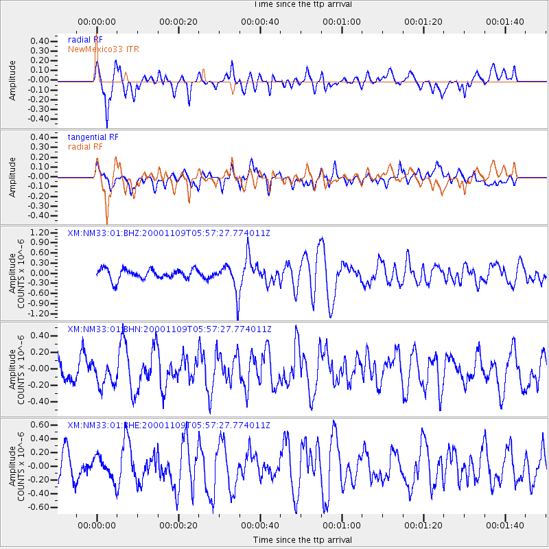
NM33 NewMexico33 - Earthquake Result Viewer
*The percent match for this event was below the threshold and hence no stack was calculated.
| Earthquake location: |
Tonga Islands |
| Earthquake latitude/longitude: |
-15.4/-173.4 |
| Earthquake time(UTC): |
2000/11/09 (314) 05:45:54 GMT |
| Earthquake Depth: |
53 km |
| Earthquake Magnitude: |
5.6 MB, 5.9 MW, 5.7 MW |
| Earthquake Catalog/Contributor: |
WHDF/NEIC |
|
| Network: |
XM Rio Grande Seismic Transect |
| Station: |
NM33 NewMexico33 |
| Lat/Lon: |
35.11 N/107.42 W |
| Elevation: |
2094 m |
|
| Distance: |
80.2 deg |
| Az: |
49.469 deg |
| Baz: |
243.393 deg |
| Ray Param: |
$rayparam |
*The percent match for this event was below the threshold and hence was not used in the summary stack. |
|
| Radial Match: |
81.61464 % |
| Radial Bump: |
400 |
| Transverse Match: |
62.797012 % |
| Transverse Bump: |
400 |
| SOD ConfigId: |
16820 |
| Insert Time: |
2010-02-26 17:30:38.747 +0000 |
| GWidth: |
2.5 |
| Max Bumps: |
400 |
| Tol: |
0.001 |
|
Signal To Noise
| Channel | StoN | STA | LTA |
| XM:NM33:01:BHN:20001109T05:57:27.774011Z | 1.0901817 | 1.7558885E-7 | 1.6106382E-7 |
| XM:NM33:01:BHE:20001109T05:57:27.774011Z | 0.99002016 | 1.6601656E-7 | 1.6769008E-7 |
| XM:NM33:01:BHZ:20001109T05:57:27.774011Z | 2.9408216 | 4.4876776E-7 | 1.5259945E-7 |
| Arrivals |
| Ps | |
| PpPs | |
| PsPs/PpSs | |


