You are here: Home > Network List > US - United States National Seismic Network Stations List
> Station DGMT Dagmar, Montana, USA > Earthquake Result Viewer
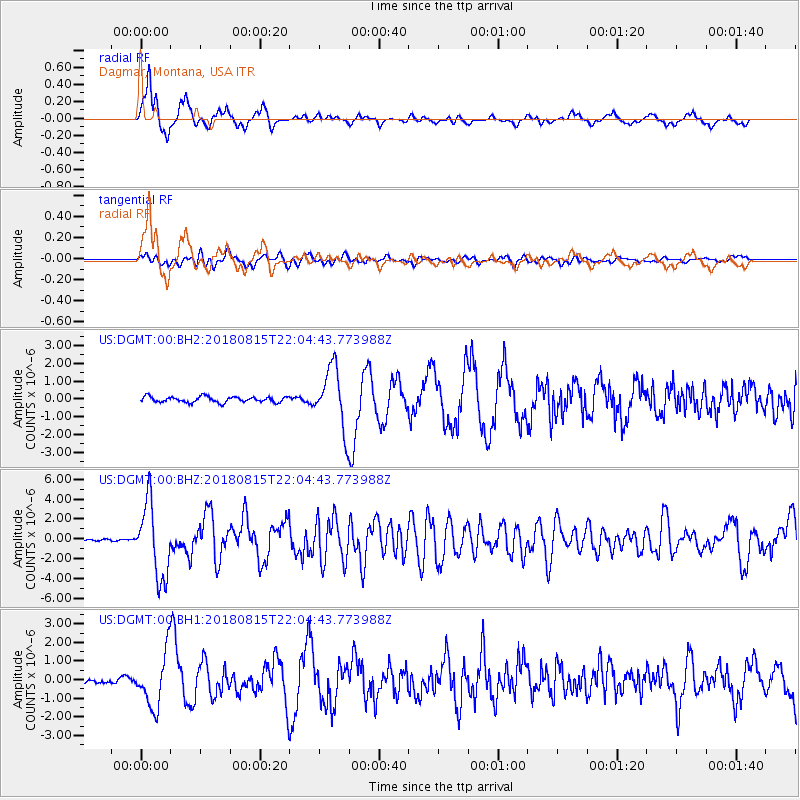
DGMT Dagmar, Montana, USA - Earthquake Result Viewer
*The percent match for this event was below the threshold and hence no stack was calculated.
| Earthquake location: |
Andreanof Islands, Aleutian Is. |
| Earthquake latitude/longitude: |
51.4/-178.1 |
| Earthquake time(UTC): |
2018/08/15 (227) 21:56:54 GMT |
| Earthquake Depth: |
20 km |
| Earthquake Magnitude: |
6.6 Mww |
| Earthquake Catalog/Contributor: |
NEIC PDE/us |
|
| Network: |
US United States National Seismic Network |
| Station: |
DGMT Dagmar, Montana, USA |
| Lat/Lon: |
48.47 N/104.20 W |
| Elevation: |
0.0 m |
|
| Distance: |
45.7 deg |
| Az: |
63.199 deg |
| Baz: |
302.908 deg |
| Ray Param: |
$rayparam |
*The percent match for this event was below the threshold and hence was not used in the summary stack. |
|
| Radial Match: |
93.500694 % |
| Radial Bump: |
400 |
| Transverse Match: |
80.54765 % |
| Transverse Bump: |
400 |
| SOD ConfigId: |
2825771 |
| Insert Time: |
2018-08-29 22:12:34.651 +0000 |
| GWidth: |
2.5 |
| Max Bumps: |
400 |
| Tol: |
0.001 |
|
Signal To Noise
| Channel | StoN | STA | LTA |
| US:DGMT:00:BHZ:20180815T22:04:43.773988Z | 42.034428 | 3.7327072E-6 | 8.8801194E-8 |
| US:DGMT:00:BH1:20180815T22:04:43.773988Z | 7.864164 | 1.4738432E-6 | 1.8741257E-7 |
| US:DGMT:00:BH2:20180815T22:04:43.773988Z | 10.798605 | 1.7218463E-6 | 1.594508E-7 |
| Arrivals |
| Ps | |
| PpPs | |
| PsPs/PpSs | |


