You are here: Home > Network List > US - United States National Seismic Network Stations List
> Station GLMI Grayling, Michigan, USA > Earthquake Result Viewer
GLMI Grayling, Michigan, USA - Earthquake Result Viewer

| Earthquake location: |
Andreanof Islands, Aleutian Is. |
| Earthquake latitude/longitude: |
51.4/-178.1 |
| Earthquake time(UTC): |
2018/08/15 (227) 21:56:54 GMT |
| Earthquake Depth: |
20 km |
| Earthquake Magnitude: |
6.6 Mww |
| Earthquake Catalog/Contributor: |
NEIC PDE/us |
|
| Network: |
US United States National Seismic Network |
| Station: |
GLMI Grayling, Michigan, USA |
| Lat/Lon: |
44.82 N/84.62 W |
| Elevation: |
387 m |
|
| Distance: |
58.6 deg |
| Az: |
56.339 deg |
| Baz: |
312.935 deg |
| Ray Param: |
0.062723435 |
| Estimated Moho Depth: |
19.5 km |
| Estimated Crust Vp/Vs: |
1.73 |
| Assumed Crust Vp: |
6.483 km/s |
| Estimated Crust Vs: |
3.753 km/s |
| Estimated Crust Poisson's Ratio: |
0.25 |
|
| Radial Match: |
94.11651 % |
| Radial Bump: |
400 |
| Transverse Match: |
75.90108 % |
| Transverse Bump: |
400 |
| SOD ConfigId: |
2825771 |
| Insert Time: |
2018-08-29 22:12:46.359 +0000 |
| GWidth: |
2.5 |
| Max Bumps: |
400 |
| Tol: |
0.001 |
|
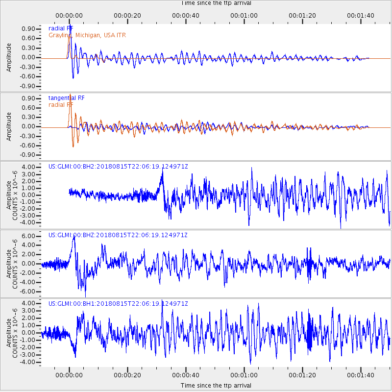
Signal To Noise
| Channel | StoN | STA | LTA |
| US:GLMI:00:BHZ:20180815T22:06:19.124971Z | 12.964713 | 3.320361E-6 | 2.5610754E-7 |
| US:GLMI:00:BH1:20180815T22:06:19.124971Z | 4.4236345 | 1.5352575E-6 | 3.4705795E-7 |
| US:GLMI:00:BH2:20180815T22:06:19.124971Z | 4.1263647 | 1.6363595E-6 | 3.96562E-7 |
| Arrivals |
| Ps | 2.3 SECOND |
| PpPs | 7.8 SECOND |
| PsPs/PpSs | 10 SECOND |


