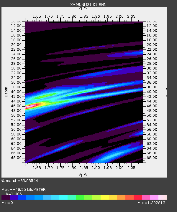
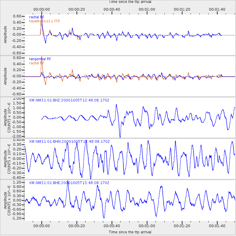
NM31 NewMexico31 - Earthquake Result Viewer

Earthquake location: Northern Mid-Atlantic Ridge
Earthquake latitude/longitude: 31.7/-41.0
Earthquake time(UTC): 2000/10/05 (279) 13:39:11 GMT
Earthquake Depth: 10 km
Earthquake Magnitude: 5.4 MB, 6.1 MS, 6.0 MW, 5.9 MW
Earthquake Catalog/Contributor: WHDF/NEIC
Network: XM Rio Grande Seismic Transect
Station: NM31 NewMexico31
Lat/Lon: 34.85 N/107.10 W
Elevation: 1676 m
Distance: 54.5 deg
Az: 292.436 deg
Baz: 73.259 deg
Ray Param: 0.06543135
Estimated Moho Depth: 46.25 km
Estimated Crust Vp/Vs: 1.61
Assumed Crust Vp: 6.502 km/s
Estimated Crust Vs: 4.051 km/s
Estimated Crust Poisson's Ratio: 0.18
Radial Match: 83.93544 %
Radial Bump: 312
Transverse Match: 54.052315 %
Transverse Bump: 357
SOD ConfigId: 3744
Insert Time: 2010-02-26 17:30:50.270 +0000
GWidth: 2.5
Max Bumps: 400
Tol: 0.001

Signal To Noise

ChannelStoNSTALTA
XM:NM31:01:BHN:20001005T13:48:08.170Z0.32099056.1177246E-81.9058896E-7
XM:NM31:01:BHE:20001005T13:48:08.170Z0.96719031.6992388E-71.7568816E-7
XM:NM31:01:BHZ:20001005T13:48:08.170Z1.21010951.6994541E-71.4043803E-7
Arrivals
Ps4.6 SECOND
PpPs17 SECOND
PsPs/PpSs22 SECOND