
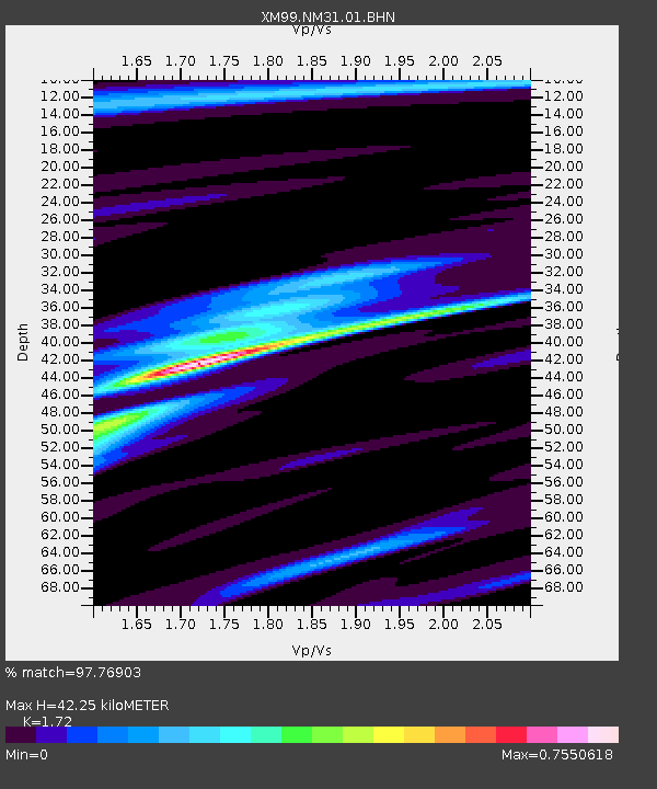
NM31 NewMexico31 - Earthquake Result Viewer
| ||||||||||||||||||
| ||||||||||||||||||
| ||||||||||||||||||
|
Signal To Noise
| Channel | StoN | STA | LTA |
| XM:NM31:01:BHN:20000328T11:12:45.806021Z | 0.5941362 | 1.2140815E-7 | 2.0434398E-7 |
| XM:NM31:01:BHE:20000328T11:12:45.806021Z | 1.6056805 | 2.5560524E-7 | 1.591881E-7 |
| XM:NM31:01:BHZ:20000328T11:12:45.806021Z | 1.3022357 | 3.9605E-7 | 3.0413082E-7 |
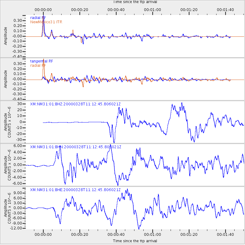
| Arrivals | |
| Ps | 4.8 SECOND |
| PpPs | 17 SECOND |
| PsPs/PpSs | 22 SECOND |

