NM31 NewMexico31 - Earthquake Result Viewer
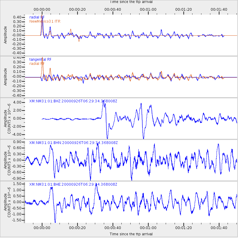
Earthquake location: Tonga Islands
Earthquake latitude/longitude: -17.2/-173.9
Earthquake time(UTC): 2000/09/26 (270) 06:17:52 GMT
Earthquake Depth: 56 km
Earthquake Magnitude: 6.1 MB, 6.1 MS, 6.4 MW, 6.1 ME
Earthquake Catalog/Contributor: WHDF/NEIC
Network: XM Rio Grande Seismic Transect
Station: NM31 NewMexico31
Lat/Lon: 34.85 N/107.10 W
Elevation: 1676 m
Distance: 81.8 deg
Az: 49.809 deg
Baz: 242.609 deg
Ray Param: 0.047217946
Estimated Moho Depth: 39.5 km
Estimated Crust Vp/Vs: 1.76
Assumed Crust Vp: 6.502 km/s
Estimated Crust Vs: 3.694 km/s
Estimated Crust Poisson's Ratio: 0.26
Radial Match: 95.74844 %
Radial Bump: 400
Transverse Match: 88.874176 %
Transverse Bump: 400
SOD ConfigId: 16820
Insert Time: 2010-02-26 17:30:57.386 +0000
GWidth: 2.5
Max Bumps: 400
Tol: 0.001

Signal To Noise

ChannelStoNSTALTA
XM:NM31:01:BHN:20000926T06:29:34.368008Z2.35465262.564535E-71.0891352E-7
XM:NM31:01:BHE:20000926T06:29:34.368008Z4.94073723.6293895E-77.3458466E-8
XM:NM31:01:BHZ:20000926T06:29:34.368008Z15.2456341.5654258E-61.02680275E-7
Arrivals
Ps4.7 SECOND
PpPs16 SECOND
PsPs/PpSs21 SECOND