You are here: Home > Network List > XM99 - Rio Grande Seismic Transect Stations List
> Station NM31 NewMexico31 > Earthquake Result Viewer
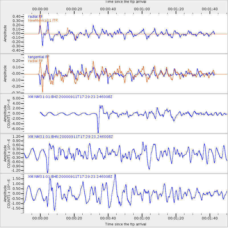
NM31 NewMexico31 - Earthquake Result Viewer
*The percent match for this event was below the threshold and hence no stack was calculated.
| Earthquake location: |
Tonga Islands |
| Earthquake latitude/longitude: |
-15.9/-173.7 |
| Earthquake time(UTC): |
2000/09/11 (255) 17:17:53 GMT |
| Earthquake Depth: |
115 km |
| Earthquake Magnitude: |
6.0 MB, 6.3 MW, 6.3 MW |
| Earthquake Catalog/Contributor: |
WHDF/NEIC |
|
| Network: |
XM Rio Grande Seismic Transect |
| Station: |
NM31 NewMexico31 |
| Lat/Lon: |
34.85 N/107.10 W |
| Elevation: |
1676 m |
|
| Distance: |
80.8 deg |
| Az: |
49.871 deg |
| Baz: |
243.461 deg |
| Ray Param: |
$rayparam |
*The percent match for this event was below the threshold and hence was not used in the summary stack. |
|
| Radial Match: |
87.29869 % |
| Radial Bump: |
358 |
| Transverse Match: |
77.400696 % |
| Transverse Bump: |
385 |
| SOD ConfigId: |
16820 |
| Insert Time: |
2010-02-26 17:31:07.873 +0000 |
| GWidth: |
2.5 |
| Max Bumps: |
400 |
| Tol: |
0.001 |
|
Signal To Noise
| Channel | StoN | STA | LTA |
| XM:NM31:01:BHN:20000911T17:29:23.246008Z | 2.8846848 | 5.261163E-7 | 1.823826E-7 |
| XM:NM31:01:BHE:20000911T17:29:23.246008Z | 1.0276681 | 5.8497557E-7 | 5.6922613E-7 |
| XM:NM31:01:BHZ:20000911T17:29:23.246008Z | 5.9722195 | 2.374655E-6 | 3.9761682E-7 |
| Arrivals |
| Ps | |
| PpPs | |
| PsPs/PpSs | |


