You are here: Home > Network List > XM99 - Rio Grande Seismic Transect Stations List
> Station NM31 NewMexico31 > Earthquake Result Viewer
NM31 NewMexico31 - Earthquake Result Viewer
*The percent match for this event was below the threshold and hence no stack was calculated.
| Earthquake location: |
Southeast Of Loyalty Islands |
| Earthquake latitude/longitude: |
-22.1/170.0 |
| Earthquake time(UTC): |
2001/02/28 (059) 13:21:29 GMT |
| Earthquake Depth: |
10 km |
| Earthquake Magnitude: |
5.6 MB |
| Earthquake Catalog/Contributor: |
WHDF/NEIC |
|
| Network: |
XM Rio Grande Seismic Transect |
| Station: |
NM31 NewMexico31 |
| Lat/Lon: |
34.85 N/107.10 W |
| Elevation: |
1676 m |
|
| Distance: |
96.8 deg |
| Az: |
55.282 deg |
| Baz: |
247.959 deg |
| Ray Param: |
$rayparam |
*The percent match for this event was below the threshold and hence was not used in the summary stack. |
|
| Radial Match: |
95.165695 % |
| Radial Bump: |
400 |
| Transverse Match: |
63.667442 % |
| Transverse Bump: |
400 |
| SOD ConfigId: |
3753 |
| Insert Time: |
2010-02-26 17:31:09.458 +0000 |
| GWidth: |
2.5 |
| Max Bumps: |
400 |
| Tol: |
0.001 |
|
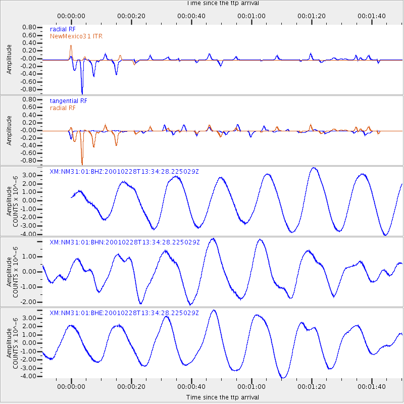
Signal To Noise
| Channel | StoN | STA | LTA |
| XM:NM31:01:BHN:20010228T13:34:28.225029Z | 1.408428 | 5.849491E-7 | 4.1532059E-7 |
| XM:NM31:01:BHE:20010228T13:34:28.225029Z | 1.4914757 | 1.7149132E-6 | 1.1498097E-6 |
| XM:NM31:01:BHZ:20010228T13:34:28.225029Z | 1.5201437 | 2.0316215E-6 | 1.3364668E-6 |
| Arrivals |
| Ps | |
| PpPs | |
| PsPs/PpSs | |


