You are here: Home > Network List > US - United States National Seismic Network Stations List
> Station MNTX Cornudas Mountains, Texas, USA > Earthquake Result Viewer
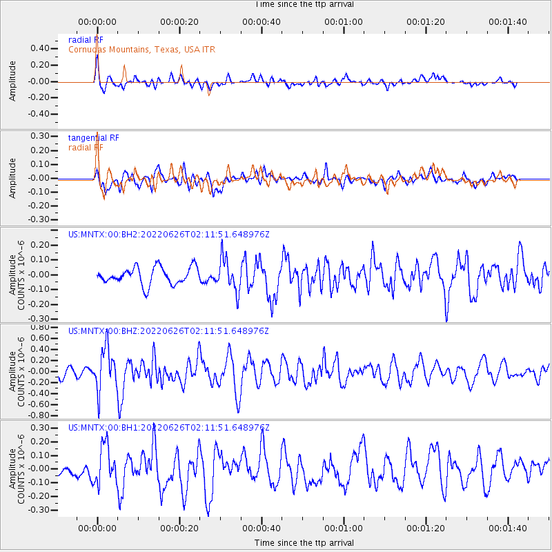
MNTX Cornudas Mountains, Texas, USA - Earthquake Result Viewer
*The percent match for this event was below the threshold and hence no stack was calculated.
| Earthquake location: |
Off Coast Of Peru |
| Earthquake latitude/longitude: |
-17.2/-73.8 |
| Earthquake time(UTC): |
2022/06/26 (177) 02:02:35 GMT |
| Earthquake Depth: |
15 km |
| Earthquake Magnitude: |
5.7 mww |
| Earthquake Catalog/Contributor: |
NEIC PDE/us |
|
| Network: |
US United States National Seismic Network |
| Station: |
MNTX Cornudas Mountains, Texas, USA |
| Lat/Lon: |
31.70 N/105.38 W |
| Elevation: |
405 m |
|
| Distance: |
57.3 deg |
| Az: |
327.921 deg |
| Baz: |
143.444 deg |
| Ray Param: |
$rayparam |
*The percent match for this event was below the threshold and hence was not used in the summary stack. |
|
| Radial Match: |
52.466537 % |
| Radial Bump: |
400 |
| Transverse Match: |
57.556553 % |
| Transverse Bump: |
400 |
| SOD ConfigId: |
28208852 |
| Insert Time: |
2022-07-10 02:32:13.785 +0000 |
| GWidth: |
2.5 |
| Max Bumps: |
400 |
| Tol: |
0.001 |
|
Signal To Noise
| Channel | StoN | STA | LTA |
| US:MNTX:00:BHZ:20220626T02:11:51.648976Z | 5.574549 | 3.9471263E-7 | 7.08062E-8 |
| US:MNTX:00:BH1:20220626T02:11:51.648976Z | 2.2150671 | 1.4024612E-7 | 6.3314616E-8 |
| US:MNTX:00:BH2:20220626T02:11:51.648976Z | 1.9451002 | 1.1256433E-7 | 5.787071E-8 |
| Arrivals |
| Ps | |
| PpPs | |
| PsPs/PpSs | |


