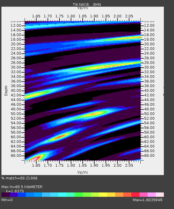
NACB NING-AN-CHIAO - Earthquake Result Viewer

Earthquake location: Nicobar Islands, India Region
Earthquake latitude/longitude: 7.9/92.2
Earthquake time(UTC): 2005/07/24 (205) 15:42:06 GMT
Earthquake Depth: 16 km
Earthquake Magnitude: 6.6 MB, 7.5 MS, 7.3 MW, 7.2 MW
Earthquake Catalog/Contributor: WHDF/NEIC
Network: TW Broadband Array in Taiwan for Seismology
Station: NACB NING-AN-CHIAO
Lat/Lon: 24.17 N/121.59 E
Elevation: 130 m
Distance: 32.4 deg
Az: 56.708 deg
Baz: 245.038 deg
Ray Param: 0.078637615
Estimated Moho Depth: 69.5 km
Estimated Crust Vp/Vs: 1.64
Assumed Crust Vp: 6.289 km/s
Estimated Crust Vs: 3.84 km/s
Estimated Crust Poisson's Ratio: 0.20
Radial Match: 88.21886 %
Radial Bump: 400
Transverse Match: 85.88529 %
Transverse Bump: 400
SOD ConfigId: 2475
Insert Time: 2010-03-09 21:42:38.587 +0000
GWidth: 2.5
Max Bumps: 400
Tol: 0.001

Signal To Noise

ChannelStoNSTALTA
TW:NACB: :BHN:20050724T15:48:04.870004Z3.29704346.32068105.03989
TW:NACB: :BHE:20050724T15:48:04.870004Z5.402823558.47186103.36668
TW:NACB: :BHZ:20050724T15:48:04.870004Z9.1935821275.135138.6984
Arrivals
Ps7.6 SECOND
PpPs27 SECOND
PsPs/PpSs35 SECOND