You are here: Home > Network List > US - United States National Seismic Network Stations List
> Station HAWA Hanford, Washington, USA > Earthquake Result Viewer
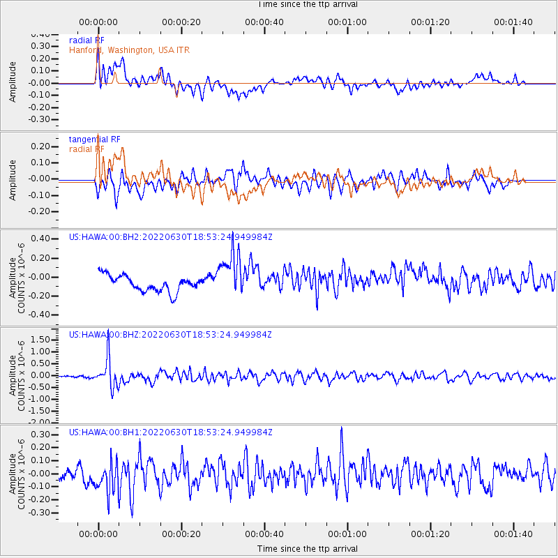
HAWA Hanford, Washington, USA - Earthquake Result Viewer
*The percent match for this event was below the threshold and hence no stack was calculated.
| Earthquake location: |
Philippine Islands Region |
| Earthquake latitude/longitude: |
19.1/121.3 |
| Earthquake time(UTC): |
2022/06/30 (181) 18:40:38 GMT |
| Earthquake Depth: |
36 km |
| Earthquake Magnitude: |
5.9 Mww |
| Earthquake Catalog/Contributor: |
NEIC PDE/us |
|
| Network: |
US United States National Seismic Network |
| Station: |
HAWA Hanford, Washington, USA |
| Lat/Lon: |
46.39 N/119.53 W |
| Elevation: |
364 m |
|
| Distance: |
94.9 deg |
| Az: |
37.342 deg |
| Baz: |
304.013 deg |
| Ray Param: |
$rayparam |
*The percent match for this event was below the threshold and hence was not used in the summary stack. |
|
| Radial Match: |
42.97837 % |
| Radial Bump: |
400 |
| Transverse Match: |
67.16968 % |
| Transverse Bump: |
400 |
| SOD ConfigId: |
28208852 |
| Insert Time: |
2022-07-14 19:03:22.052 +0000 |
| GWidth: |
2.5 |
| Max Bumps: |
400 |
| Tol: |
0.001 |
|
Signal To Noise
| Channel | StoN | STA | LTA |
| US:HAWA:00:BHZ:20220630T18:53:24.949984Z | 8.667865 | 6.483654E-7 | 7.480106E-8 |
| US:HAWA:00:BH1:20220630T18:53:24.949984Z | 2.194409 | 1.3742358E-7 | 6.262442E-8 |
| US:HAWA:00:BH2:20220630T18:53:24.949984Z | 2.983215 | 2.449365E-7 | 8.2104876E-8 |
| Arrivals |
| Ps | |
| PpPs | |
| PsPs/PpSs | |


