You are here: Home > Network List > UW - Pacific Northwest Regional Seismic Network Stations List
> Station HOOD Mt Hood Meadows, OR CREST BB SMO > Earthquake Result Viewer
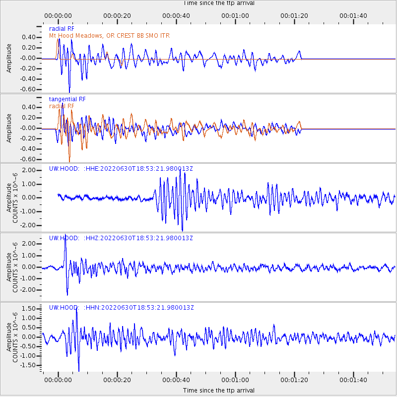
HOOD Mt Hood Meadows, OR CREST BB SMO - Earthquake Result Viewer
*The percent match for this event was below the threshold and hence no stack was calculated.
| Earthquake location: |
Philippine Islands Region |
| Earthquake latitude/longitude: |
19.1/121.3 |
| Earthquake time(UTC): |
2022/06/30 (181) 18:40:38 GMT |
| Earthquake Depth: |
36 km |
| Earthquake Magnitude: |
5.9 Mww |
| Earthquake Catalog/Contributor: |
NEIC PDE/us |
|
| Network: |
UW Pacific Northwest Regional Seismic Network |
| Station: |
HOOD Mt Hood Meadows, OR CREST BB SMO |
| Lat/Lon: |
45.32 N/121.65 W |
| Elevation: |
1520 m |
|
| Distance: |
94.2 deg |
| Az: |
39.055 deg |
| Baz: |
302.36 deg |
| Ray Param: |
$rayparam |
*The percent match for this event was below the threshold and hence was not used in the summary stack. |
|
| Radial Match: |
79.615845 % |
| Radial Bump: |
400 |
| Transverse Match: |
76.286026 % |
| Transverse Bump: |
400 |
| SOD ConfigId: |
28208852 |
| Insert Time: |
2022-07-14 19:04:14.618 +0000 |
| GWidth: |
2.5 |
| Max Bumps: |
400 |
| Tol: |
0.001 |
|
Signal To Noise
| Channel | StoN | STA | LTA |
| UW:HOOD: :HHZ:20220630T18:53:21.980013Z | 15.422672 | 9.878361E-7 | 6.40509E-8 |
| UW:HOOD: :HHN:20220630T18:53:21.980013Z | 4.0924296 | 4.1062881E-7 | 1.00338646E-7 |
| UW:HOOD: :HHE:20220630T18:53:21.980013Z | 4.9192476 | 4.7597476E-7 | 9.6757624E-8 |
| Arrivals |
| Ps | |
| PpPs | |
| PsPs/PpSs | |


