You are here: Home > Network List > US - United States National Seismic Network Stations List
> Station DUG Dugway, Tooele County, Utah, USA > Earthquake Result Viewer
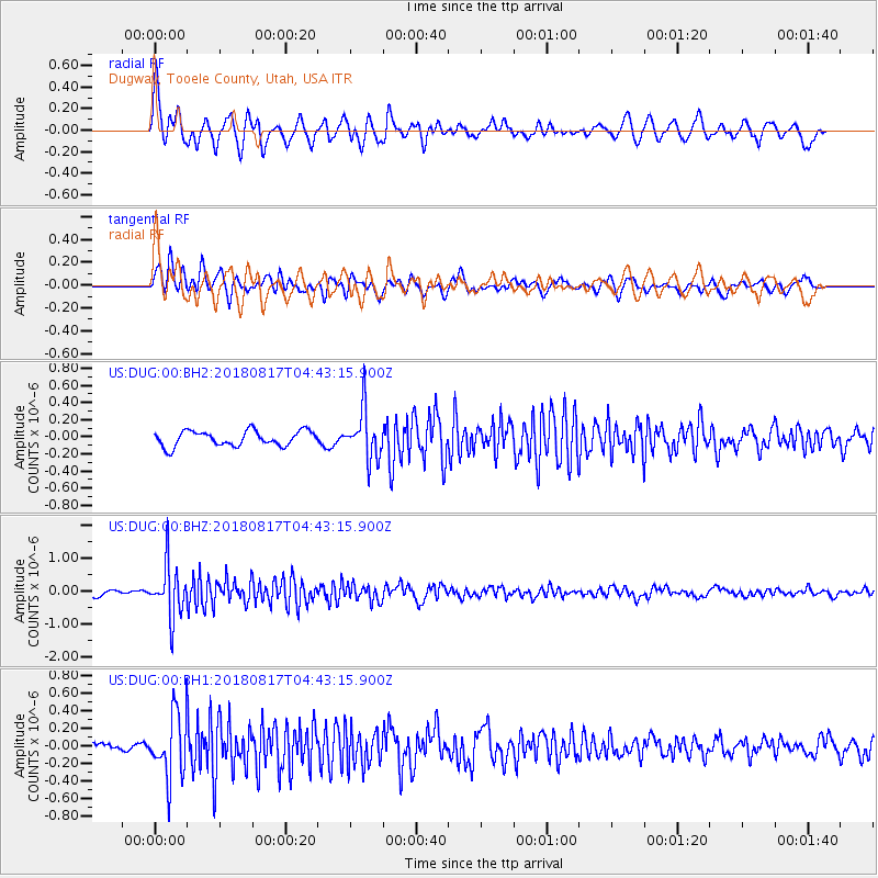
DUG Dugway, Tooele County, Utah, USA - Earthquake Result Viewer
*The percent match for this event was below the threshold and hence no stack was calculated.
| Earthquake location: |
Andreanof Islands, Aleutian Is. |
| Earthquake latitude/longitude: |
51.3/-178.2 |
| Earthquake time(UTC): |
2018/08/17 (229) 04:35:29 GMT |
| Earthquake Depth: |
25 km |
| Earthquake Magnitude: |
5.8 Ml |
| Earthquake Catalog/Contributor: |
NEIC PDE/us |
|
| Network: |
US United States National Seismic Network |
| Station: |
DUG Dugway, Tooele County, Utah, USA |
| Lat/Lon: |
40.19 N/112.81 W |
| Elevation: |
1477 m |
|
| Distance: |
45.5 deg |
| Az: |
77.481 deg |
| Baz: |
306.92 deg |
| Ray Param: |
$rayparam |
*The percent match for this event was below the threshold and hence was not used in the summary stack. |
|
| Radial Match: |
75.679436 % |
| Radial Bump: |
400 |
| Transverse Match: |
68.46031 % |
| Transverse Bump: |
400 |
| SOD ConfigId: |
2825771 |
| Insert Time: |
2018-08-31 04:50:38.984 +0000 |
| GWidth: |
2.5 |
| Max Bumps: |
400 |
| Tol: |
0.001 |
|
Signal To Noise
| Channel | StoN | STA | LTA |
| US:DUG:00:BHZ:20180817T04:43:15.900Z | 10.315919 | 7.8400336E-7 | 7.5999374E-8 |
| US:DUG:00:BH1:20180817T04:43:15.900Z | 5.527207 | 3.627435E-7 | 6.562872E-8 |
| US:DUG:00:BH2:20180817T04:43:15.900Z | 3.2683423 | 2.8710215E-7 | 8.784336E-8 |
| Arrivals |
| Ps | |
| PpPs | |
| PsPs/PpSs | |


