NM27 NewMexico27 - Earthquake Result Viewer
Earthquake location: Vanuatu Islands
Earthquake latitude/longitude: -15.4/166.9
Earthquake time(UTC): 2000/10/04 (278) 16:58:44 GMT
Earthquake Depth: 23 km
Earthquake Magnitude: 6.1 MB, 6.9 MS, 6.8 MW, 6.5 ME
Earthquake Catalog/Contributor: WHDF/NEIC
Network: XM Rio Grande Seismic Transect
Station: NM27 NewMexico27
Lat/Lon: 34.39 N/106.52 W
Elevation: 1870 m
Distance: 95.8 deg
Az: 56.074 deg
Baz: 255.386 deg
Ray Param: 0.040682577
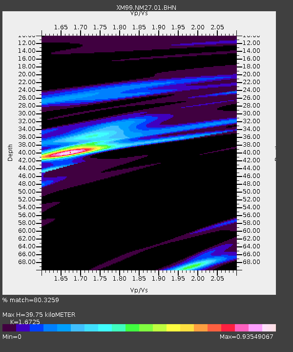
Estimated Moho Depth: 39.75 km
Estimated Crust Vp/Vs: 1.67
Assumed Crust Vp: 6.502 km/s
Estimated Crust Vs: 3.887 km/s
Estimated Crust Poisson's Ratio: 0.22
Radial Match: 80.3259 %
Radial Bump: 400
Transverse Match: 56.25697 %
Transverse Bump: 400
SOD ConfigId: 16820
Insert Time: 2010-02-26 17:31:47.128 +0000
GWidth: 2.5
Max Bumps: 400
Tol: 0.001

Signal To Noise

ChannelStoNSTALTA
XM:NM27:01:BHN:20001004T17:11:36.916018Z1.36882841.1470092E-78.379496E-8
XM:NM27:01:BHE:20001004T17:11:36.916018Z2.00862222.1316526E-71.0612512E-7
XM:NM27:01:BHZ:20001004T17:11:36.916018Z3.7675514.2601164E-71.1307389E-7
Arrivals
Ps4.2 SECOND
PpPs16 SECOND
PsPs/PpSs20 SECOND