You are here: Home > Network List > PF - Volcanologic Network of Piton de Fournaise-OVPF Stations List
> Station HIM cratere Himiltrude > Earthquake Result Viewer
HIM cratere Himiltrude - Earthquake Result Viewer
*The percent match for this event was below the threshold and hence no stack was calculated.
| Earthquake location: |
Flores Sea |
| Earthquake latitude/longitude: |
-7.4/119.8 |
| Earthquake time(UTC): |
2018/08/17 (229) 15:35:02 GMT |
| Earthquake Depth: |
539 km |
| Earthquake Magnitude: |
6.5 Mww |
| Earthquake Catalog/Contributor: |
NEIC PDE/us |
|
| Network: |
PF Volcanologic Network of Piton de Fournaise-OVPF |
| Station: |
HIM cratere Himiltrude |
| Lat/Lon: |
21.21 S/55.72 E |
| Elevation: |
1958 m |
|
| Distance: |
63.2 deg |
| Az: |
250.061 deg |
| Baz: |
87.675 deg |
| Ray Param: |
$rayparam |
*The percent match for this event was below the threshold and hence was not used in the summary stack. |
|
| Radial Match: |
61.32375 % |
| Radial Bump: |
400 |
| Transverse Match: |
65.04923 % |
| Transverse Bump: |
362 |
| SOD ConfigId: |
2825771 |
| Insert Time: |
2018-08-31 15:40:38.404 +0000 |
| GWidth: |
2.5 |
| Max Bumps: |
400 |
| Tol: |
0.001 |
|
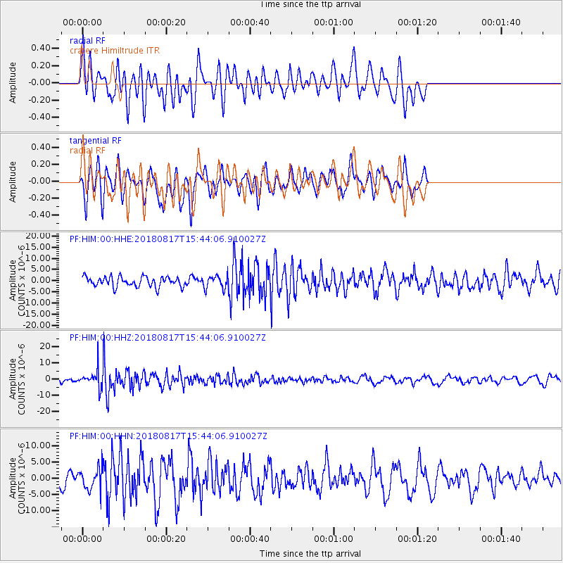
Signal To Noise
| Channel | StoN | STA | LTA |
| PF:HIM:00:HHZ:20180817T15:44:06.910027Z | 3.1127279 | 5.5014602E-6 | 1.767408E-6 |
| PF:HIM:00:HHN:20180817T15:44:06.910027Z | 1.6103745 | 3.324304E-6 | 2.0643051E-6 |
| PF:HIM:00:HHE:20180817T15:44:06.910027Z | 1.3445039 | 3.006591E-6 | 2.2362085E-6 |
| Arrivals |
| Ps | |
| PpPs | |
| PsPs/PpSs | |


