You are here: Home > Network List > IU - Global Seismograph Network (GSN - IRIS/USGS) Stations List
> Station PMG Port Moresby, New Guinea > Earthquake Result Viewer
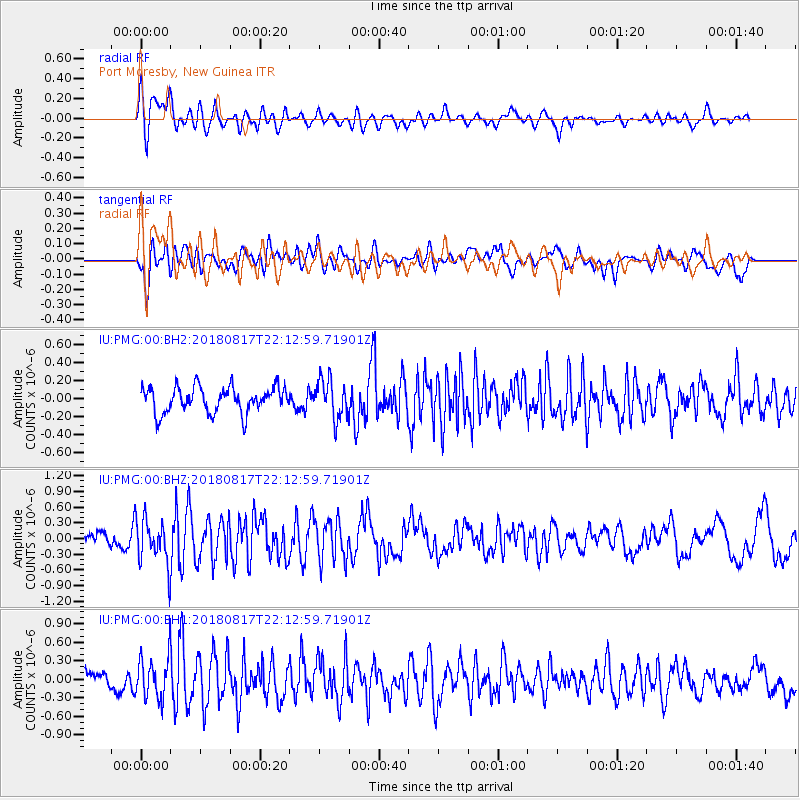
PMG Port Moresby, New Guinea - Earthquake Result Viewer
*The percent match for this event was below the threshold and hence no stack was calculated.
| Earthquake location: |
Volcano Islands, Japan Region |
| Earthquake latitude/longitude: |
23.5/143.3 |
| Earthquake time(UTC): |
2018/08/17 (229) 22:06:57 GMT |
| Earthquake Depth: |
18 km |
| Earthquake Magnitude: |
5.5 Mww |
| Earthquake Catalog/Contributor: |
NEIC PDE/us |
|
| Network: |
IU Global Seismograph Network (GSN - IRIS/USGS) |
| Station: |
PMG Port Moresby, New Guinea |
| Lat/Lon: |
9.40 S/147.16 E |
| Elevation: |
90 m |
|
| Distance: |
32.9 deg |
| Az: |
173.06 deg |
| Baz: |
353.545 deg |
| Ray Param: |
$rayparam |
*The percent match for this event was below the threshold and hence was not used in the summary stack. |
|
| Radial Match: |
75.323685 % |
| Radial Bump: |
400 |
| Transverse Match: |
62.892475 % |
| Transverse Bump: |
400 |
| SOD ConfigId: |
2825771 |
| Insert Time: |
2018-08-31 22:12:30.630 +0000 |
| GWidth: |
2.5 |
| Max Bumps: |
400 |
| Tol: |
0.001 |
|
Signal To Noise
| Channel | StoN | STA | LTA |
| IU:PMG:00:BHZ:20180817T22:12:59.71901Z | 4.82623 | 4.3509448E-7 | 9.0152035E-8 |
| IU:PMG:00:BH1:20180817T22:12:59.71901Z | 2.8322973 | 3.5146024E-7 | 1.2409016E-7 |
| IU:PMG:00:BH2:20180817T22:12:59.71901Z | 1.4974399 | 2.125228E-7 | 1.4192409E-7 |
| Arrivals |
| Ps | |
| PpPs | |
| PsPs/PpSs | |


