You are here: Home > Network List > US - United States National Seismic Network Stations List
> Station HLID Hailey, Idaho, USA > Earthquake Result Viewer
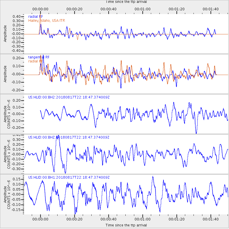
HLID Hailey, Idaho, USA - Earthquake Result Viewer
*The percent match for this event was below the threshold and hence no stack was calculated.
| Earthquake location: |
Volcano Islands, Japan Region |
| Earthquake latitude/longitude: |
23.5/143.3 |
| Earthquake time(UTC): |
2018/08/17 (229) 22:06:57 GMT |
| Earthquake Depth: |
18 km |
| Earthquake Magnitude: |
5.5 Mww |
| Earthquake Catalog/Contributor: |
NEIC PDE/us |
|
| Network: |
US United States National Seismic Network |
| Station: |
HLID Hailey, Idaho, USA |
| Lat/Lon: |
43.56 N/114.41 W |
| Elevation: |
1772 m |
|
| Distance: |
82.5 deg |
| Az: |
45.77 deg |
| Baz: |
295.169 deg |
| Ray Param: |
$rayparam |
*The percent match for this event was below the threshold and hence was not used in the summary stack. |
|
| Radial Match: |
61.26244 % |
| Radial Bump: |
400 |
| Transverse Match: |
67.95938 % |
| Transverse Bump: |
400 |
| SOD ConfigId: |
2825771 |
| Insert Time: |
2018-08-31 22:14:50.959 +0000 |
| GWidth: |
2.5 |
| Max Bumps: |
400 |
| Tol: |
0.001 |
|
Signal To Noise
| Channel | StoN | STA | LTA |
| US:HLID:00:BHZ:20180817T22:18:47.374009Z | 1.4409914 | 9.889646E-8 | 6.863085E-8 |
| US:HLID:00:BH1:20180817T22:18:47.374009Z | 1.4812676 | 1.0221515E-7 | 6.900519E-8 |
| US:HLID:00:BH2:20180817T22:18:47.374009Z | 2.2720938 | 1.0414585E-7 | 4.5836952E-8 |
| Arrivals |
| Ps | |
| PpPs | |
| PsPs/PpSs | |


