You are here: Home > Network List > US - United States National Seismic Network Stations List
> Station MSO Missoula, Montana, USA > Earthquake Result Viewer
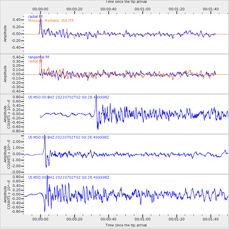
MSO Missoula, Montana, USA - Earthquake Result Viewer
*The percent match for this event was below the threshold and hence no stack was calculated.
| Earthquake location: |
Hokkaido, Japan Region |
| Earthquake latitude/longitude: |
45.9/142.1 |
| Earthquake time(UTC): |
2022/07/02 (183) 01:59:45 GMT |
| Earthquake Depth: |
322 km |
| Earthquake Magnitude: |
5.8 mww |
| Earthquake Catalog/Contributor: |
NEIC PDE/us |
|
| Network: |
US United States National Seismic Network |
| Station: |
MSO Missoula, Montana, USA |
| Lat/Lon: |
46.83 N/113.94 W |
| Elevation: |
1264 m |
|
| Distance: |
66.1 deg |
| Az: |
46.783 deg |
| Baz: |
312.146 deg |
| Ray Param: |
$rayparam |
*The percent match for this event was below the threshold and hence was not used in the summary stack. |
|
| Radial Match: |
77.639755 % |
| Radial Bump: |
400 |
| Transverse Match: |
78.46694 % |
| Transverse Bump: |
400 |
| SOD ConfigId: |
28208852 |
| Insert Time: |
2022-07-16 02:40:04.681 +0000 |
| GWidth: |
2.5 |
| Max Bumps: |
400 |
| Tol: |
0.001 |
|
Signal To Noise
| Channel | StoN | STA | LTA |
| US:MSO:00:BHZ:20220702T02:09:28.499998Z | 13.034853 | 1.0915666E-6 | 8.3742144E-8 |
| US:MSO:00:BH1:20220702T02:09:28.499998Z | 5.738831 | 3.2914394E-7 | 5.7353827E-8 |
| US:MSO:00:BH2:20220702T02:09:28.499998Z | 6.3538823 | 3.4313834E-7 | 5.4004516E-8 |
| Arrivals |
| Ps | |
| PpPs | |
| PsPs/PpSs | |


