NM26 NewMexico26 - Earthquake Result Viewer
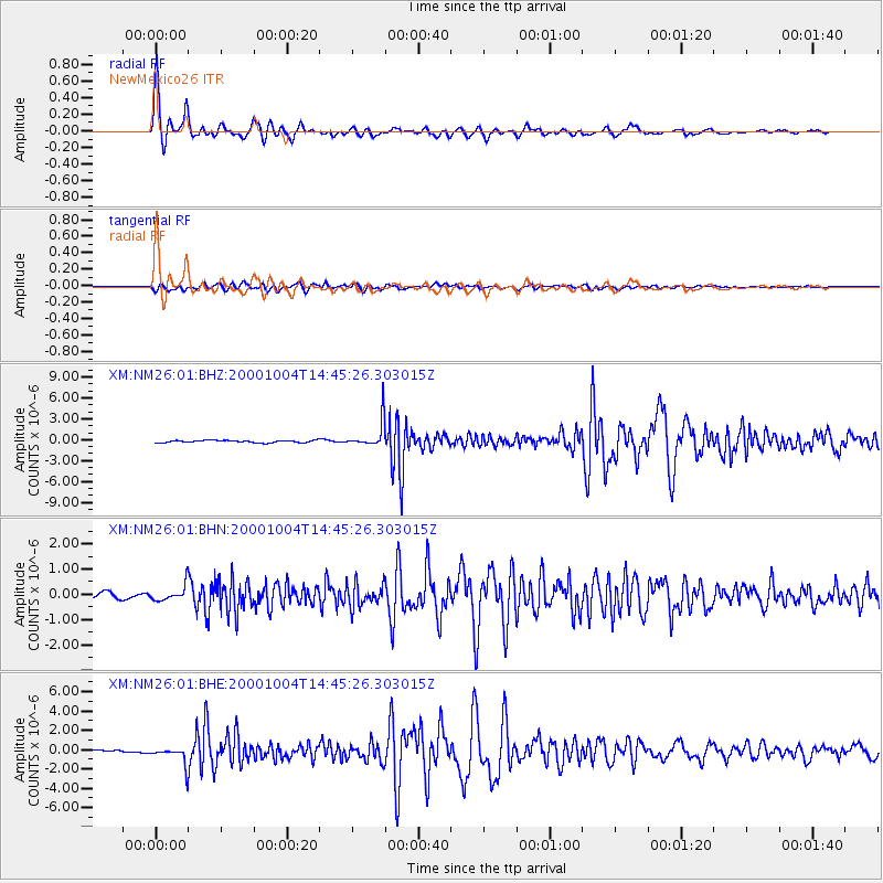
Earthquake location: Windward Islands
Earthquake latitude/longitude: 11.1/-62.6
Earthquake time(UTC): 2000/10/04 (278) 14:37:44 GMT
Earthquake Depth: 110 km
Earthquake Magnitude: 5.6 MB, 5.4 MS, 6.1 MW, 5.9 MD
Earthquake Catalog/Contributor: WHDF/NEIC
Network: XM Rio Grande Seismic Transect
Station: NM26 NewMexico26
Lat/Lon: 34.26 N/106.36 W
Elevation: 1854 m
Distance: 46.0 deg
Az: 307.219 deg
Baz: 109.322 deg
Ray Param: 0.07052045
Estimated Moho Depth: 40.25 km
Estimated Crust Vp/Vs: 1.74
Assumed Crust Vp: 6.502 km/s
Estimated Crust Vs: 3.737 km/s
Estimated Crust Poisson's Ratio: 0.25
Radial Match: 97.94896 %
Radial Bump: 347
Transverse Match: 87.78045 %
Transverse Bump: 400
SOD ConfigId: 16820
Insert Time: 2010-02-26 17:32:17.459 +0000
GWidth: 2.5
Max Bumps: 400
Tol: 0.001

Signal To Noise

ChannelStoNSTALTA
XM:NM26:01:BHN:20001004T14:45:26.303015Z2.55339313.0083422E-71.17817436E-7
XM:NM26:01:BHE:20001004T14:45:26.303015Z6.68524369.174163E-71.3723005E-7
XM:NM26:01:BHZ:20001004T14:45:26.303015Z11.8490651.9397303E-61.6370322E-7
Arrivals
Ps4.9 SECOND
PpPs16 SECOND
PsPs/PpSs21 SECOND