NM26 NewMexico26 - Earthquake Result Viewer
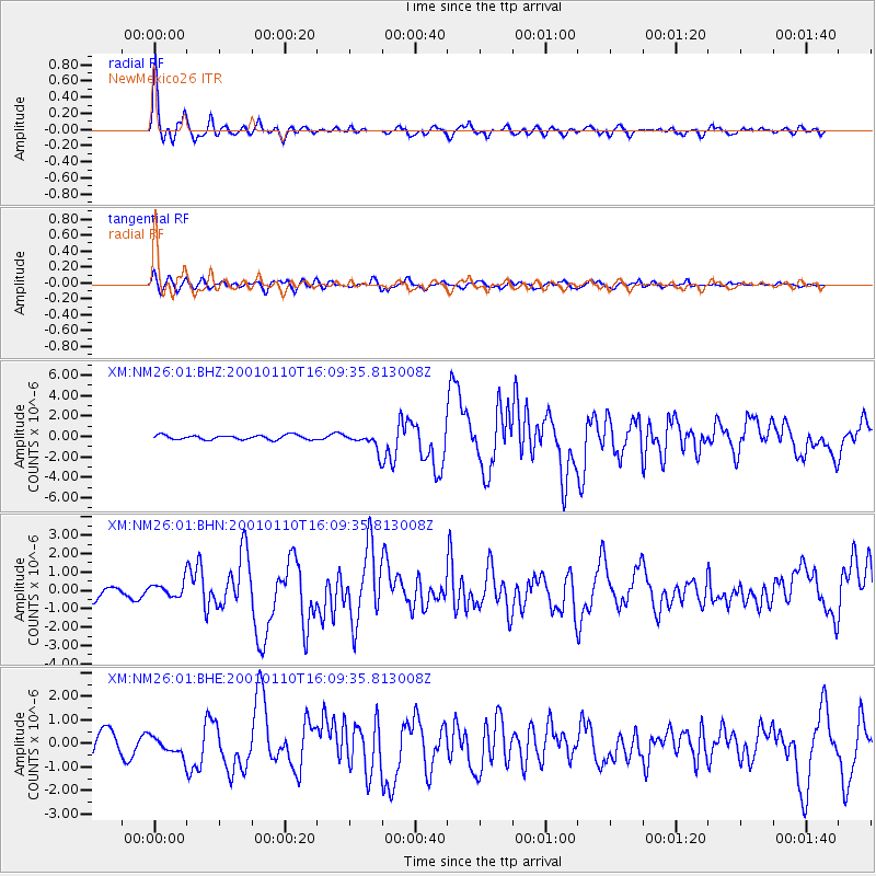
Earthquake location: Kodiak Island Region, Alaska
Earthquake latitude/longitude: 57.1/-153.2
Earthquake time(UTC): 2001/01/10 (010) 16:02:44 GMT
Earthquake Depth: 33 km
Earthquake Magnitude: 6.2 MB, 6.8 MS, 7.1 MW, 6.8 ML
Earthquake Catalog/Contributor: WHDF/NEIC
Network: XM Rio Grande Seismic Transect
Station: NM26 NewMexico26
Lat/Lon: 34.26 N/106.36 W
Elevation: 1854 m
Distance: 38.8 deg
Az: 105.583 deg
Baz: 320.573 deg
Ray Param: 0.07526085
Estimated Moho Depth: 42.5 km
Estimated Crust Vp/Vs: 1.60
Assumed Crust Vp: 6.502 km/s
Estimated Crust Vs: 4.063 km/s
Estimated Crust Poisson's Ratio: 0.18
Radial Match: 92.03537 %
Radial Bump: 400
Transverse Match: 67.907776 %
Transverse Bump: 400
SOD ConfigId: 16820
Insert Time: 2010-02-26 17:32:20.874 +0000
GWidth: 2.5
Max Bumps: 400
Tol: 0.001

Signal To Noise

ChannelStoNSTALTA
XM:NM26:01:BHN:20010110T16:09:35.813008Z1.05507683.8895786E-73.686536E-7
XM:NM26:01:BHE:20010110T16:09:35.813008Z0.95788763.696953E-73.859485E-7
XM:NM26:01:BHZ:20010110T16:09:35.813008Z3.90508968.6899166E-72.2252797E-7
Arrivals
Ps4.3 SECOND
PpPs16 SECOND
PsPs/PpSs20 SECOND