NM26 NewMexico26 - Earthquake Result Viewer
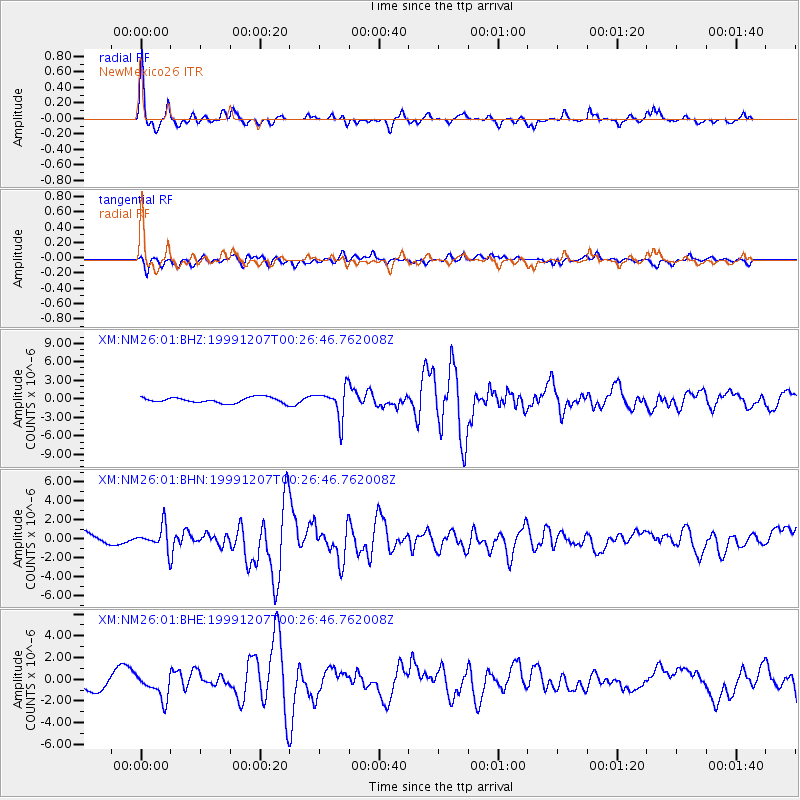
Earthquake location: Kodiak Island Region, Alaska
Earthquake latitude/longitude: 57.4/-154.5
Earthquake time(UTC): 1999/12/07 (341) 00:19:49 GMT
Earthquake Depth: 41 km
Earthquake Magnitude: 6.5 MB, 6.1 MS, 6.4 MW, 6.3 ML
Earthquake Catalog/Contributor: WHDF/NEIC
Network: XM Rio Grande Seismic Transect
Station: NM26 NewMexico26
Lat/Lon: 34.26 N/106.36 W
Elevation: 1854 m
Distance: 39.6 deg
Az: 104.601 deg
Baz: 320.716 deg
Ray Param: 0.07479311
Estimated Moho Depth: 40.25 km
Estimated Crust Vp/Vs: 1.69
Assumed Crust Vp: 6.502 km/s
Estimated Crust Vs: 3.853 km/s
Estimated Crust Poisson's Ratio: 0.23
Radial Match: 82.240776 %
Radial Bump: 319
Transverse Match: 65.86456 %
Transverse Bump: 400
SOD ConfigId: 27569
Insert Time: 2010-02-26 17:32:32.860 +0000
GWidth: 2.5
Max Bumps: 400
Tol: 0.001

Signal To Noise

ChannelStoNSTALTA
XM:NM26:01:BHN:19991207T00:26:46.762008Z1.76639841.2285536E-66.9551334E-7
XM:NM26:01:BHE:19991207T00:26:46.762008Z2.11000731.1194222E-65.3053003E-7
XM:NM26:01:BHZ:19991207T00:26:46.762008Z5.34233952.4069159E-64.5053594E-7
Arrivals
Ps4.6 SECOND
PpPs15 SECOND
PsPs/PpSs20 SECOND