NM25 NewMexico25 - Earthquake Result Viewer
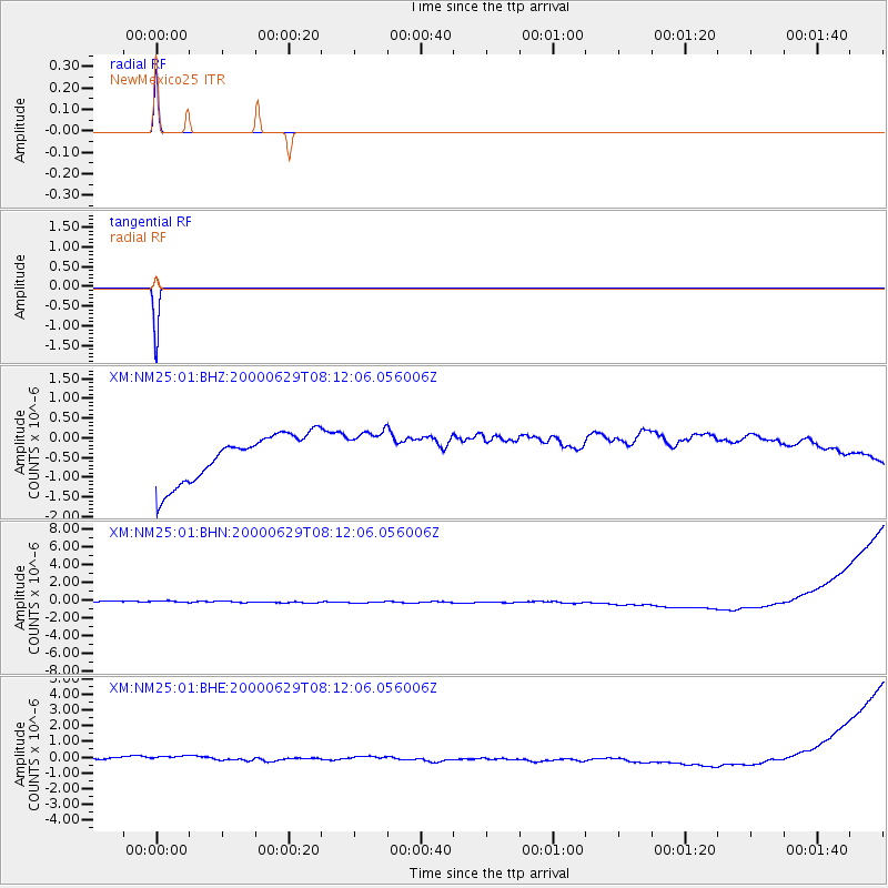
Earthquake location: Mariana Islands
Earthquake latitude/longitude: 13.0/144.5
Earthquake time(UTC): 2000/06/29 (181) 07:59:06 GMT
Earthquake Depth: 52 km
Earthquake Magnitude: 5.5 MB, 5.5 MS, 5.9 MW, 5.8 MW
Earthquake Catalog/Contributor: WHDF/NEIC
Network: XM Rio Grande Seismic Transect
Station: NM25 NewMexico25
Lat/Lon: 34.17 N/106.26 W
Elevation: 1933 m
Distance: 98.1 deg
Az: 52.267 deg
Baz: 291.63 deg
Ray Param: 0.03998014
Estimated Moho Depth: 10.0 km
Estimated Crust Vp/Vs: 1.60
Assumed Crust Vp: 6.502 km/s
Estimated Crust Vs: 4.063 km/s
Estimated Crust Poisson's Ratio: 0.18
Radial Match: 99.91958 %
Radial Bump: 13
Transverse Match: 99.99483 %
Transverse Bump: 2
SOD ConfigId: 16820
Insert Time: 2010-02-26 17:33:08.094 +0000
GWidth: 2.5
Max Bumps: 400
Tol: 0.001

Signal To Noise

ChannelStoNSTALTA
XM:NM25:01:BHN:20000629T08:12:06.056006Z0.89763086.015817E-76.701883E-7
XM:NM25:01:BHE:20000629T08:12:06.056006Z1.33226175.16692E-73.8783074E-7
XM:NM25:01:BHZ:20000629T08:12:06.056006Z0.91789695.483327E-75.9737937E-7
Arrivals
Ps0.9 SECOND
PpPs3.9 SECOND
PsPs/PpSs4.9 SECOND