You are here: Home > Network List > IW - Intermountain West Stations List
> Station MOOW Moose Ponds, Wyoming, USA > Earthquake Result Viewer
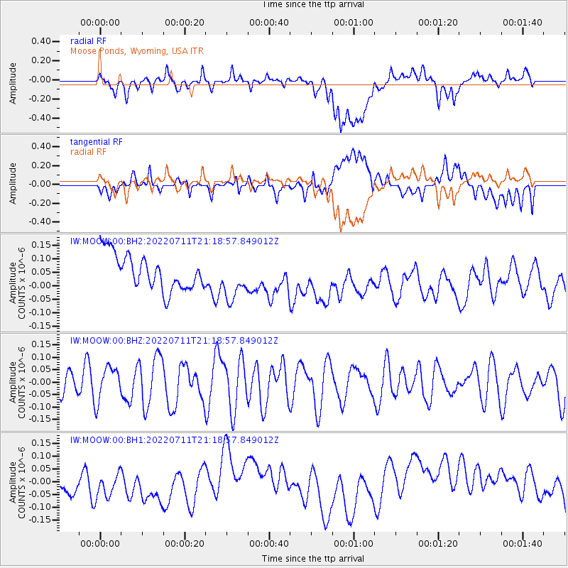
MOOW Moose Ponds, Wyoming, USA - Earthquake Result Viewer
*The percent match for this event was below the threshold and hence no stack was calculated.
| Earthquake location: |
Vanuatu Islands |
| Earthquake latitude/longitude: |
-18.1/169.0 |
| Earthquake time(UTC): |
2022/07/11 (192) 21:06:04 GMT |
| Earthquake Depth: |
10 km |
| Earthquake Magnitude: |
5.7 mww |
| Earthquake Catalog/Contributor: |
NEIC PDE/us |
|
| Network: |
IW Intermountain West |
| Station: |
MOOW Moose Ponds, Wyoming, USA |
| Lat/Lon: |
43.75 N/110.74 W |
| Elevation: |
2128 m |
|
| Distance: |
95.5 deg |
| Az: |
45.847 deg |
| Baz: |
250.303 deg |
| Ray Param: |
$rayparam |
*The percent match for this event was below the threshold and hence was not used in the summary stack. |
|
| Radial Match: |
31.580893 % |
| Radial Bump: |
400 |
| Transverse Match: |
32.143158 % |
| Transverse Bump: |
400 |
| SOD ConfigId: |
28208852 |
| Insert Time: |
2022-07-25 21:22:02.853 +0000 |
| GWidth: |
2.5 |
| Max Bumps: |
400 |
| Tol: |
0.001 |
|
Signal To Noise
| Channel | StoN | STA | LTA |
| IW:MOOW:00:BHZ:20220711T21:18:57.849012Z | 1.6942056 | 6.5910754E-8 | 3.8903636E-8 |
| IW:MOOW:00:BH1:20220711T21:18:57.849012Z | 0.74235106 | 9.784288E-8 | 1.3180136E-7 |
| IW:MOOW:00:BH2:20220711T21:18:57.849012Z | 1.2339137 | 8.0203336E-8 | 6.499915E-8 |
| Arrivals |
| Ps | |
| PpPs | |
| PsPs/PpSs | |


