NM25 NewMexico25 - Earthquake Result Viewer
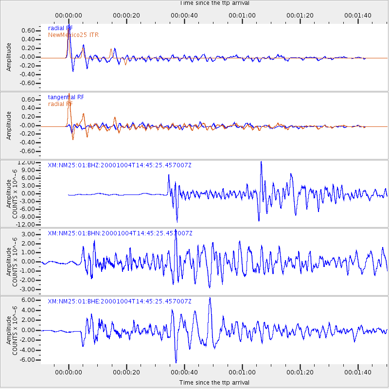
Earthquake location: Windward Islands
Earthquake latitude/longitude: 11.1/-62.6
Earthquake time(UTC): 2000/10/04 (278) 14:37:44 GMT
Earthquake Depth: 110 km
Earthquake Magnitude: 5.6 MB, 5.4 MS, 6.1 MW, 5.9 MD
Earthquake Catalog/Contributor: WHDF/NEIC
Network: XM Rio Grande Seismic Transect
Station: NM25 NewMexico25
Lat/Lon: 34.17 N/106.26 W
Elevation: 1933 m
Distance: 45.9 deg
Az: 307.132 deg
Baz: 109.319 deg
Ray Param: 0.070589446
Estimated Moho Depth: 39.75 km
Estimated Crust Vp/Vs: 1.81
Assumed Crust Vp: 6.502 km/s
Estimated Crust Vs: 3.602 km/s
Estimated Crust Poisson's Ratio: 0.28
Radial Match: 96.68092 %
Radial Bump: 400
Transverse Match: 88.51248 %
Transverse Bump: 400
SOD ConfigId: 16820
Insert Time: 2010-02-26 17:33:14.988 +0000
GWidth: 2.5
Max Bumps: 400
Tol: 0.001

Signal To Noise

ChannelStoNSTALTA
XM:NM25:01:BHN:20001004T14:45:25.457007Z2.53780753.3075105E-71.3032944E-7
XM:NM25:01:BHE:20001004T14:45:25.457007Z4.67757277.14623E-71.5277647E-7
XM:NM25:01:BHZ:20001004T14:45:25.457007Z10.5702381.853153E-61.75318E-7
Arrivals
Ps5.2 SECOND
PpPs16 SECOND
PsPs/PpSs21 SECOND