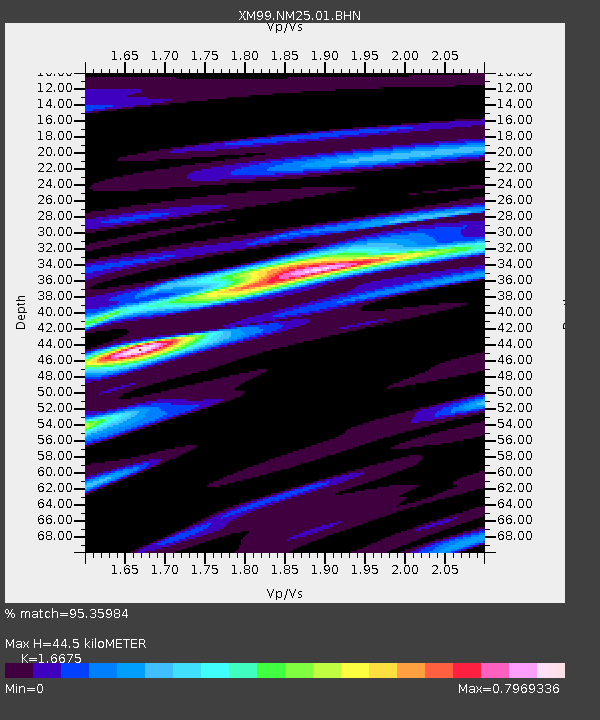
NM25 NewMexico25 - Earthquake Result Viewer
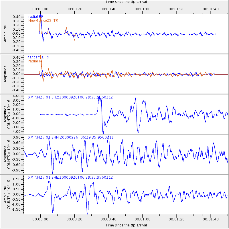
Earthquake location: Tonga Islands
Earthquake latitude/longitude: -17.2/-173.9
Earthquake time(UTC): 2000/09/26 (270) 06:17:52 GMT
Earthquake Depth: 56 km
Earthquake Magnitude: 6.1 MB, 6.1 MS, 6.4 MW, 6.1 ME
Earthquake Catalog/Contributor: WHDF/NEIC
Network: XM Rio Grande Seismic Transect
Station: NM25 NewMexico25
Lat/Lon: 34.17 N/106.26 W
Elevation: 1933 m
Distance: 82.1 deg
Az: 50.739 deg
Baz: 243.211 deg
Ray Param: 0.04700553
Estimated Moho Depth: 44.5 km
Estimated Crust Vp/Vs: 1.67
Assumed Crust Vp: 6.502 km/s
Estimated Crust Vs: 3.899 km/s
Estimated Crust Poisson's Ratio: 0.22
Radial Match: 95.35984 %
Radial Bump: 400
Transverse Match: 87.04258 %
Transverse Bump: 400
SOD ConfigId: 16820
Insert Time: 2010-02-26 17:33:17.147 +0000
GWidth: 2.5
Max Bumps: 400
Tol: 0.001

Signal To Noise

ChannelStoNSTALTA
XM:NM25:01:BHN:20000926T06:29:35.956021Z3.37071783.067822E-79.101391E-8
XM:NM25:01:BHE:20000926T06:29:35.956021Z5.24349744.5165086E-78.613542E-8
XM:NM25:01:BHZ:20000926T06:29:35.956021Z17.4795511.5523468E-68.880931E-8
Arrivals
Ps4.7 SECOND
PpPs18 SECOND
PsPs/PpSs22 SECOND