You are here: Home > Network List > IW - Intermountain West Stations List
> Station MOOW Moose Ponds, Wyoming, USA > Earthquake Result Viewer
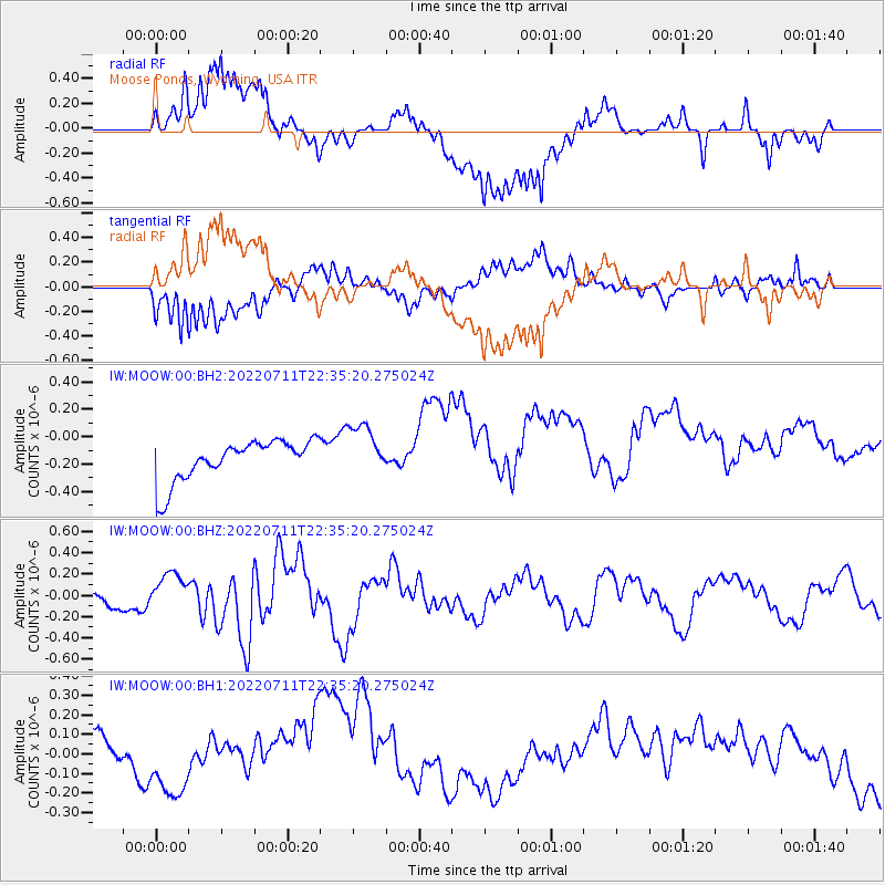
MOOW Moose Ponds, Wyoming, USA - Earthquake Result Viewer
*The percent match for this event was below the threshold and hence no stack was calculated.
| Earthquake location: |
Samoa Islands Region |
| Earthquake latitude/longitude: |
-15.2/-172.6 |
| Earthquake time(UTC): |
2022/07/11 (192) 22:23:35 GMT |
| Earthquake Depth: |
10 km |
| Earthquake Magnitude: |
6.0 Mi |
| Earthquake Catalog/Contributor: |
NEIC PDE/pt |
|
| Network: |
IW Intermountain West |
| Station: |
MOOW Moose Ponds, Wyoming, USA |
| Lat/Lon: |
43.75 N/110.74 W |
| Elevation: |
2128 m |
|
| Distance: |
81.4 deg |
| Az: |
40.256 deg |
| Baz: |
239.398 deg |
| Ray Param: |
$rayparam |
*The percent match for this event was below the threshold and hence was not used in the summary stack. |
|
| Radial Match: |
51.996635 % |
| Radial Bump: |
400 |
| Transverse Match: |
49.784443 % |
| Transverse Bump: |
400 |
| SOD ConfigId: |
28208852 |
| Insert Time: |
2022-07-25 22:39:46.620 +0000 |
| GWidth: |
2.5 |
| Max Bumps: |
400 |
| Tol: |
0.001 |
|
Signal To Noise
| Channel | StoN | STA | LTA |
| IW:MOOW:00:BHZ:20220711T22:35:20.275024Z | 2.5679 | 1.746869E-7 | 6.802714E-8 |
| IW:MOOW:00:BH1:20220711T22:35:20.275024Z | 0.27468216 | 7.664685E-8 | 2.7903835E-7 |
| IW:MOOW:00:BH2:20220711T22:35:20.275024Z | 1.3020686 | 1.9402269E-7 | 1.4901111E-7 |
| Arrivals |
| Ps | |
| PpPs | |
| PsPs/PpSs | |


