
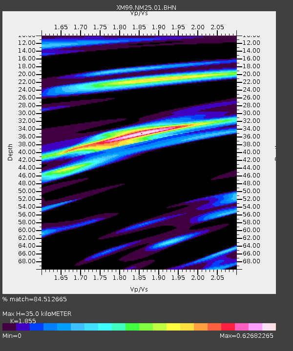
NM25 NewMexico25 - Earthquake Result Viewer
| ||||||||||||||||||
| ||||||||||||||||||
| ||||||||||||||||||
|
Signal To Noise
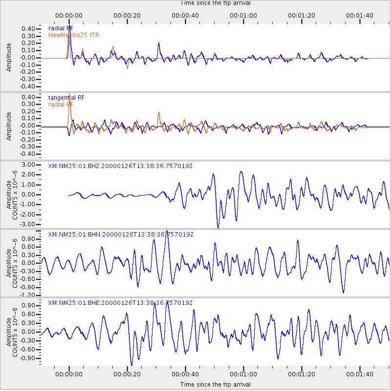
| Channel | StoN | STA | LTA |
| XM:NM25:01:BHN:20000126T13:38:36.757019Z | 1.196574 | 2.1577532E-7 | 1.803276E-7 |
| XM:NM25:01:BHE:20000126T13:38:36.757019Z | 0.82650816 | 1.3071156E-7 | 1.5814913E-7 |
| XM:NM25:01:BHZ:20000126T13:38:36.757019Z | 1.7211083 | 2.3324324E-7 | 1.3551922E-7 |
| Arrivals | |
| Ps | 4.7 SECOND |
| PpPs | 15 SECOND |
| PsPs/PpSs | 20 SECOND |

