You are here: Home > Network List > CN - Canadian National Seismograph Network Stations List
> Station INK INUVIK, NT > Earthquake Result Viewer
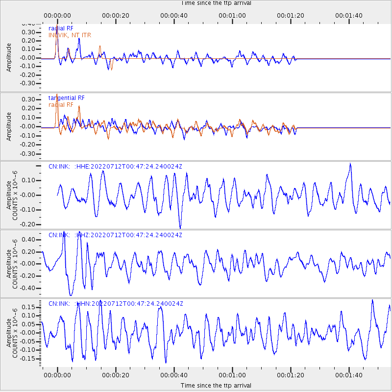
INK INUVIK, NT - Earthquake Result Viewer
*The percent match for this event was below the threshold and hence no stack was calculated.
| Earthquake location: |
Samoa Islands Region |
| Earthquake latitude/longitude: |
-15.3/-172.9 |
| Earthquake time(UTC): |
2022/07/12 (193) 00:35:05 GMT |
| Earthquake Depth: |
10 km |
| Earthquake Magnitude: |
5.5 mb |
| Earthquake Catalog/Contributor: |
NEIC PDE/us |
|
| Network: |
CN Canadian National Seismograph Network |
| Station: |
INK INUVIK, NT |
| Lat/Lon: |
68.31 N/133.53 W |
| Elevation: |
44 m |
|
| Distance: |
88.0 deg |
| Az: |
13.665 deg |
| Baz: |
217.831 deg |
| Ray Param: |
$rayparam |
*The percent match for this event was below the threshold and hence was not used in the summary stack. |
|
| Radial Match: |
72.11728 % |
| Radial Bump: |
344 |
| Transverse Match: |
62.174294 % |
| Transverse Bump: |
400 |
| SOD ConfigId: |
28208852 |
| Insert Time: |
2022-07-26 00:48:15.874 +0000 |
| GWidth: |
2.5 |
| Max Bumps: |
400 |
| Tol: |
0.001 |
|
Signal To Noise
| Channel | StoN | STA | LTA |
| CN:INK: :HHZ:20220712T00:47:24.240024Z | 3.8340437 | 2.8726112E-7 | 7.49238E-8 |
| CN:INK: :HHN:20220712T00:47:24.240024Z | 0.93046516 | 6.8896334E-8 | 7.404504E-8 |
| CN:INK: :HHE:20220712T00:47:24.240024Z | 1.1230026 | 7.86799E-8 | 7.006208E-8 |
| Arrivals |
| Ps | |
| PpPs | |
| PsPs/PpSs | |


